IMAGES TAKEN NEAR TO
Waltham Place, CHESTER, CH4 8EF
Introduction
This page details the photographs taken nearby to Waltham Place, CH4 8EF by members of the Geograph project.
The Geograph project started in 2005 with the aim of publishing, organising and preserving representative images for every square kilometre of Great Britain, Ireland and the Isle of Man.

There are currently over 7.5m images from over14,400 individuals and you can help contribute to the project by visiting https://www.geograph.org.uk
Image Map
Images are licensed for reuse under creativecommons.org/licenses/by-sa/2.0
Notes
- Clicking on the map will re-center to the selected point.
- The higher the marker number, the further away the image location is from the centre of the postcode.
Image Listing (14 Images Found)
Images are licensed for reuse under creativecommons.org/licenses/by-sa/2.0
Image
Details
Distance
1

Tudor Court, Hough Green
Protracted discussions about this redundant and burnt out nursing home, at the very desirable residential address of Hough Green, Chester, mean it has stood empty for some years. Some recent tidying up of the site suggests that at last it is about to be re-developed. The traffic lights indicate where the local Cliveden Road, coming from the right, joins Hough Green.
Next see Image
Image: © John S Turner
Taken: 23 Dec 2006
0.17 miles
2
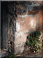
Benchmark by Hough Green, Chester
A Weathered Ordnance Survey benchmark by the side gateway to #2 Woodlands Road, which faces Hough Green.
Benchmark Database: https://www.bench-marks.org.uk/bm184299
Image: © John S Turner
Taken: 13 Feb 2023
0.18 miles
3
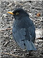
Male blackbird foraging in Westminster Park
Image: © John S Turner
Taken: 11 Feb 2023
0.18 miles
4
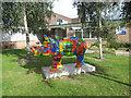
Rhino Mania - #46 African Rhino outside the Lache Community Centre
"African Rhino" is seen here outside the Lache Community Centre in Hawthorn Road. The design is inspired by colourful African designs and animals.
Artist: Alison Pitt
Sponsor: Lache Adventure Playground Association
Image: © John S Turner
Taken: 11 Sep 2010
0.18 miles
5
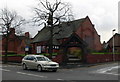
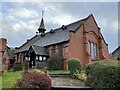
St Mark, Lache and Saltney
The church was consecrated in 1893.
Image: © Eirian Evans
Taken: 7 Dec 2007
0.19 miles
6
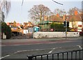
Tudor Court, Hough Green - Gone.
The earlier photos at SJ3965 : Tudor Court, Hough Green explain that Tudor Court nursing home had been derelict for some time. Demolition is now complete, apart from site clearance, so it will be interesting to see what takes its place. See also Image and Image The traffic lights indicate where the local Cliveden Road, coming from the right, joins Hough Green.
Image: © John S Turner
Taken: 17 Feb 2007
0.19 miles
7
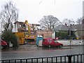
Tudor Court, Hough Green - Going
The earlier photo at Image explains that Tudor Court nursing home has been derelict for some time. At last demolition has started so presumably redevelopment plans have now been approved. The traffic lights indicate where the local Cliveden Road, coming from the right, joins Hough Green.
Image: © John S Turner
Taken: 9 Feb 2007
0.20 miles
8
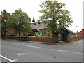
St Mark's church, Saltney
St Mark's was built in 1892 by T M Lockwood. The structure is Ruabon red brick and the roof is 'graded Westmorland slate'; it is Grade II listed. The perimeter wall is contemporaneous with the church but the Lych gate dates to 1920 and is separately listed Grade II. Analysis of the distances between marks on the surveyors schedule for the First Geodetic Levelling Chester to Flint section, seems to indicate that there was a bench mark at this location on a gate post on the south side of the road. However, the gatepost should be west of the brick works, which was actually west of it. Today the church is surrounded by housing.
Image: © John S Turner
Taken: 18 Sep 2009
0.21 miles
9
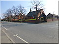
St Mark's church on Chester Road, Saltney
Image: © Raymond Knapman
Taken: 25 Mar 2015
0.21 miles