IMAGES TAKEN NEAR TO
Park Road, WIRRAL, CH48 4DN
Introduction
This page details the photographs taken nearby to Park Road, CH48 4DN by members of the Geograph project.
The Geograph project started in 2005 with the aim of publishing, organising and preserving representative images for every square kilometre of Great Britain, Ireland and the Isle of Man.

There are currently over 7.5m images from over14,400 individuals and you can help contribute to the project by visiting https://www.geograph.org.uk
Image Map
Images are licensed for reuse under creativecommons.org/licenses/by-sa/2.0
Notes
- Clicking on the map will re-center to the selected point.
- The higher the marker number, the further away the image location is from the centre of the postcode.
Image Listing (97 Images Found)
Images are licensed for reuse under creativecommons.org/licenses/by-sa/2.0
Image
Details
Distance
1
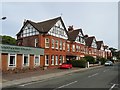
More houses on Westbourne Road
Similar in date and sharing some details with other pre-1899 properties in the street suggesting same architect/developer. The original Methodist Chapel dates from same period.
Image: © John M
Taken: 9 Jun 2017
0.06 miles
2

West Kirby Methodist Church
The new Wesleyan Methodist Church building opened in 1904.
Image: © John M
Taken: 9 Jun 2017
0.06 miles
3
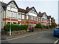
Houses on Westbourne Road
Pre 1899 development on Westbourne Road ties in with the new railway line from Birkenhead and Liverpool.
Image: © John M
Taken: 9 Jun 2017
0.08 miles
4
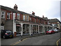
Shops with verandah on Acacia Grove, West Kirby
The verandah appears somewhat rickety, but still provides welcome shelter for window shoppers, and for smokers outside the cafe.
Image: © Richard Vince
Taken: 5 Mar 2016
0.09 miles
5

Westbourne Hall
Built as a Parish Hall for St Brigids (Church of England) in 1915 and taken over by the local authority in 1994. A charitable Joint Management Committee now leases the hall.
Image: © John M
Taken: 9 Jun 2017
0.09 miles
8
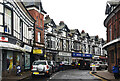
The Crescent, West Kirby
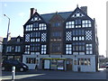
The Crescent is a major shopping street in West Kirby. Its distinctive row of black and white buildings are probably of 19th or early 20th century date.
Image: © Rod Grealish
Taken: 29 Aug 2024
0.10 miles
9
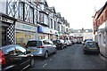
The Crescent, West Kirby
Looking west along The Crescent towards Banks Road (the B5141).
Image: © Jeff Buck
Taken: 24 Nov 2016
0.11 miles