
IMAGES TAKEN NEAR TO
The Waltons, CHESTER, CH4 7EA
Introduction
This page details the photographs taken nearby to The Waltons, CH4 7EA by members of the Geograph project.
The Geograph project started in 2005 with the aim of publishing, organising and preserving representative images for every square kilometre of Great Britain, Ireland and the Isle of Man.

There are currently over 7.5m images from over14,400 individuals and you can help contribute to the project by visiting https://www.geograph.org.uk
Image Map
Images are licensed for reuse under creativecommons.org/licenses/by-sa/2.0
Notes
- Clicking on the map will re-center to the selected point.
- The higher the marker number, the further away the image location is from the centre of the postcode.
Image Listing (11 Images Found)
Images are licensed for reuse under creativecommons.org/licenses/by-sa/2.0
Image
Details
Distance
1

'Chester Cross 1 Mile' post in Eaton Road
This milepost stands alongside Eaton Road and was repainted in 2017. It was cast pre 1891 by R T Smith of Whitchurch, Salop.
Image: © John S Turner
Taken: 11 Dec 2017
0.08 miles
2

Old Milepost in Eaton Road, Handbridge, Chester
Cast iron post by the A548, in parish of CHESTER (CHESTER District), back to sandstone wall, on West side of Eaton Road. Chester Cross iron plate & post, cast pre 1891 by R T Smith of Whitchurch, Salop, erected by the County Council in the 19th century.
Inscription reads:- : CHESTER CROSS / 1 MILE :
Listed.
Milestone Society National ID: CH_CHQF01.
Image: © J Higgins
Taken: 1 Jun 2004
0.08 miles
3
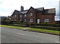
Houses on Eaton Road
A pair of red brick semi-detached houses on the southern approach to Handbridge. An escutcheon on the front walls say they were built in 1863.
Image: © Eirian Evans
Taken: 24 Feb 2016
0.09 miles
4
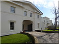
Gateway to Greenbank House
This has also been recently converted into two dwellings.
Image: © Eirian Evans
Taken: 24 Feb 2016
0.10 miles
5
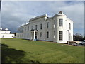
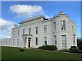
Greenbank Hall, Handbridge
Formerly a country house, then a catering college. It was built c1820, and converted to a non-residential college c1980 by Cheshire County Architect's Department. It has recently been converted once more into 7 mansion apartments.
Image: © Eirian Evans
Taken: 24 Feb 2016
0.12 miles
7

Bench mark in Eaton Road, Handbridge
This indistinct Ordnance Survey bench mark is on the end of the boundary wall between Handbridge College and Netherfield. The mark only dates to 1954. See also Image
Image: © John S Turner
Taken: 15 Oct 2018
0.18 miles

9
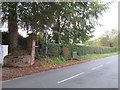
Eaton Road, opposite Eccleston Avenue
Looking across Eaton Road from Eccleston Avenue, with the entrance to Netherfield on the left. Playing fields for West Cheshire College are behind the hedge. The brick pillar has an Ordnance Survey bench mark - Image
Image: © John S Turner
Taken: 15 Oct 2018
0.19 miles
10

Bench mark in front of #51 Eaton Road, Handbridge
This bench mark is on the old sandstone wall alongside Eaton Road, in front of #51. The mark may be the one shown on the 1874 O.S. map. The stone wall once bounded allotment gardens, but when modern houses were built in the late 1960s they were set back from the wall and were provided with their own footpath between the wall and their gardens. See also Image For details see http://www.bench-marks.org.uk/bm72242
Image: © John S Turner
Taken: 14 Dec 2015
0.23 miles