
IMAGES TAKEN NEAR TO
Valentia Road, WIRRAL, CH47 2AW
Introduction
This page details the photographs taken nearby to Valentia Road, CH47 2AW by members of the Geograph project.
The Geograph project started in 2005 with the aim of publishing, organising and preserving representative images for every square kilometre of Great Britain, Ireland and the Isle of Man.

There are currently over 7.5m images from over14,400 individuals and you can help contribute to the project by visiting https://www.geograph.org.uk
Image Map
Images are licensed for reuse under creativecommons.org/licenses/by-sa/2.0
Notes
- Clicking on the map will re-center to the selected point.
- The higher the marker number, the further away the image location is from the centre of the postcode.
Image Listing (75 Images Found)
Images are licensed for reuse under creativecommons.org/licenses/by-sa/2.0
Image
Details
Distance
1
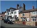
Lake Place and "The Lake" public House
Lake Place with "The Lake" public House and adjacent sandstone cottages, part of the old village of Hoose which faced the open ground of sea marsh and sandhills of the Mersey estuary. Hoose consisted of mainly fishermen's cottages with a parish church, lighthouse, lifeboat house and a coastguard station.
Image: © Sue Adair
Taken: 19 Jul 2018
0.07 miles
2
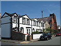
Alderley Road Cottages and Church
Cottages in Alderley Road built at the end of the 19th century and the former Welsh Presbyterian church built 1905.
Image: © Sue Adair
Taken: 19 Jul 2018
0.09 miles
3
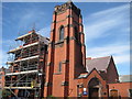
Former Hoylake Welsh Presbyterian Church
The former Hoylake Welsh Presbyterian church (later United Reformed) during renovations in 2010. It was built 1905, closed in 2014 and sold by auction with plans to build apartments but has so far been saved from demolition. The revised scheme is to convert the church into 11 apartments and the former church hall into four two-bedroom houses, rather than knocking it down.
Image: © Sue Adair
Taken: 5 Jul 2010
0.09 miles
4
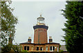
Hoylake lighthouse
Now a private house. Built 1864 extinguished 1886, inland on Valentia road.
Image: © Steve Fareham
Taken: 7 Oct 2007
0.13 miles
5
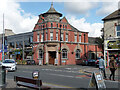
52 Market Street, Hoylake
Built for the Bank of Liverpool in 1904-05 by Willink & Thicknesse. Grade II listed.
It is/was Bank Coffee Shop.
Image: © Stephen Richards
Taken: 22 Aug 2014
0.14 miles
6
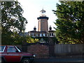
Original Hoylake Lighthouse
An octagonal brick tower built in 1865 on the site of the original lighthouse. It is now part of a private house.
Image: © Eirian Evans
Taken: 12 Sep 2009
0.14 miles
7
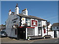
The Plasterers Arms
The Plasterers Arms in Back Sea View is a traditional local pub in the historic residential quarter of Hoylake village which was once called Hoose, the inhabitants of which were principally boatmen and fishermen. In 1871 census John Youds of the adjacent Grove Road was a plasterer and beer house keeper so it is possible the pub name came from this.
Image: © Sue Adair
Taken: 19 Jul 2018
0.15 miles
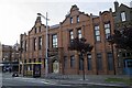
9
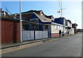
Hoylake Sailing Club
Founded in 1887 on Hoylake Promenade. At that time, it was possible to sail just in front of the clubhouse but this is no longer possible because of sand deposition.
Image: © Eirian Evans
Taken: 12 Sep 2009
0.16 miles
10
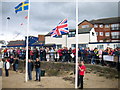
Hoylake Sailing Club
When the sailing club on Hoylake Promenade was founded in 1887 it was possible to launch boats and sail immediately in front of the clubhouse. Now, due to lack of water caused by sand deposition, sailing takes place farther along the promenade or offshore and is only possible inshore immediately off the clubhouse on the very highest spring tides. The abundance of sand is a boon to sand-yachters, here raising the flags in the opening ceremony of the 2007 European Sandyacht Championship.
Image: © John Hughes
Taken: 16 Sep 2007
0.17 miles