Lake Place and "The Lake" public House
Introduction
The photograph on this page of Lake Place and "The Lake" public House by Sue Adair as part of the Geograph project.
The Geograph project started in 2005 with the aim of publishing, organising and preserving representative images for every square kilometre of Great Britain, Ireland and the Isle of Man.

There are currently over 7.5m images from over 14,400 individuals and you can help contribute to the project by visiting https://www.geograph.org.uk
Lake Place and "The Lake" public House
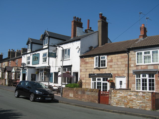
Image: © Sue Adair Taken: 19 Jul 2018
Lake Place with "The Lake" public House and adjacent sandstone cottages, part of the old village of Hoose which faced the open ground of sea marsh and sandhills of the Mersey estuary. Hoose consisted of mainly fishermen's cottages with a parish church, lighthouse, lifeboat house and a coastguard station.
Images are licensed for reuse under creativecommons.org/licenses/by-sa/2.0
Image Location
Latitude
53.393806
Longitude
-3.178629