
IMAGES TAKEN NEAR TO
Glen Park Road, WALLASEY, CH45 5JL
Introduction
This page details the photographs taken nearby to Glen Park Road, CH45 5JL by members of the Geograph project.
The Geograph project started in 2005 with the aim of publishing, organising and preserving representative images for every square kilometre of Great Britain, Ireland and the Isle of Man.

There are currently over 7.5m images from over14,400 individuals and you can help contribute to the project by visiting https://www.geograph.org.uk
Image Map
Images are licensed for reuse under creativecommons.org/licenses/by-sa/2.0
Notes
- Clicking on the map will re-center to the selected point.
- The higher the marker number, the further away the image location is from the centre of the postcode.
Image Listing (21 Images Found)
Images are licensed for reuse under creativecommons.org/licenses/by-sa/2.0
Image
Details
Distance
1
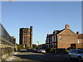
Wallasey Waterworks Tower, New Brighton
Now a century old, the tower of Wallasey Waterworks, like its neighbour the Church of SS Peter and Paul, is another landmark on the New Brighton skyline.
Image: © Sue Adair
Taken: 13 Nov 2005
0.08 miles
2
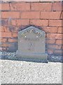
Old Milepost by Mount Road, New Brighton
Cast-iron post on the UC road, New Brighton, Merseyside; Mount Road, No. 54 against front wall, South-West side of road. C19, probably erected by the Wallasey Local Board in connection with goods or passenger transport.
Inscription reads:-
SEACOMBE
FERRY
M
2½
Milestone Society ID: CH_SCF02A.
Image: © Milestone Society
Taken: 4 Jul 2018
0.10 miles
3
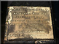
Dedication plaque for Mount Road Reservoir
Constructed in 1886 by the Wallasey Local Board.
Image: © Karl and Ali
Taken: 23 Feb 2018
0.12 miles
4
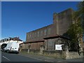
Jubilee Church, Wallasey
Previously the Anglican church of All Saints and left incomplete. The architect was Sir Giles Gilbert Scott; work began in 1927. Since 2013 it has been the home of Jubilee Church, an independent evangelical church
Image: © David Smith
Taken: 28 Apr 2024
0.15 miles
5
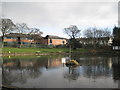
Captain's Pit, Hose Side Road
Fishing pond in Hose Side Rd, a corruption of the word hoes, meaning sandhill, for this road was once a gated private road through the sandhills. Associated with a couple of local legends, this possible marl pit is popular with local anglers. In the very early days of the history of Liscard Castle when it was known as Marina Villa, a sea captain took his new bride to live there, who, on receiving news of his drowning at sea, drowned herself in a nearby small lake. This eventually became known as the 'Captain's Pit' and her spirit is said to haunt Liscard Castle to this day.
Image: © Sue Adair
Taken: 8 Jan 2011
0.15 miles
7
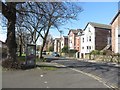
Mount Road, Wallasey
A residential street in Wallasey. On its southern side are several three storey semi detached houses.
Image: © Graham Robson
Taken: 26 Mar 2018
0.16 miles
8
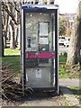
Telephone box, Mount Road, Wallasey
A tired looking public telephone box on Mount Road in Wallasey. The phone box's location on the street can be seen in Image
Image: © Graham Robson
Taken: 26 Mar 2018
0.17 miles
9
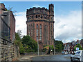
Water tower, Gorsehill Road, Wallasey
Built 1905 by J.H. Crowther. The younger and marginally daintier sister of Image Grade II listed.
Image: © Stephen Richards
Taken: 22 Aug 2014
0.17 miles
10
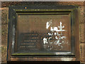
Dedication plaque on Wallasey Waterworks Tower
Set in the side of Image Sadly defaced by painted graffiti.
Image: © Karl and Ali
Taken: 23 Feb 2018
0.17 miles