Captain's Pit, Hose Side Road
Introduction
The photograph on this page of Captain's Pit, Hose Side Road by Sue Adair as part of the Geograph project.
The Geograph project started in 2005 with the aim of publishing, organising and preserving representative images for every square kilometre of Great Britain, Ireland and the Isle of Man.

There are currently over 7.5m images from over 14,400 individuals and you can help contribute to the project by visiting https://www.geograph.org.uk
Captain's Pit, Hose Side Road
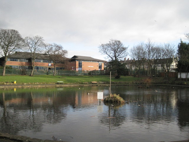
Image: © Sue Adair Taken: 8 Jan 2011
Fishing pond in Hose Side Rd, a corruption of the word hoes, meaning sandhill, for this road was once a gated private road through the sandhills. Associated with a couple of local legends, this possible marl pit is popular with local anglers. In the very early days of the history of Liscard Castle when it was known as Marina Villa, a sea captain took his new bride to live there, who, on receiving news of his drowning at sea, drowned herself in a nearby small lake. This eventually became known as the 'Captain's Pit' and her spirit is said to haunt Liscard Castle to this day.
Images are licensed for reuse under creativecommons.org/licenses/by-sa/2.0
Image Location
Latitude
53.429507
Longitude
-3.051985