
IMAGES TAKEN NEAR TO
Limekiln Lane, WALLASEY, CH44 5SR
Introduction
This page details the photographs taken nearby to Limekiln Lane, CH44 5SR by members of the Geograph project.
The Geograph project started in 2005 with the aim of publishing, organising and preserving representative images for every square kilometre of Great Britain, Ireland and the Isle of Man.

There are currently over 7.5m images from over14,400 individuals and you can help contribute to the project by visiting https://www.geograph.org.uk
Image Map
Images are licensed for reuse under creativecommons.org/licenses/by-sa/2.0
Notes
- Clicking on the map will re-center to the selected point.
- The higher the marker number, the further away the image location is from the centre of the postcode.
Image Listing (18 Images Found)
Images are licensed for reuse under creativecommons.org/licenses/by-sa/2.0
Image
Details
Distance
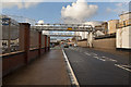
2
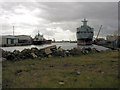
West Float from the west end
View down West Float from the site of the former swing bridge leading into Bidston Dock, the filled in passage between the two docks can be seen in the foreground.
Image: © George Robinson
Taken: 19 May 2007
0.13 miles
3
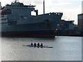
Members of Liverpool Victoria Rowing Club on West Dock
Image: © Norman Caesar
Taken: 10 Nov 2016
0.15 miles
4
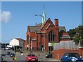
St Luke's Church Poulton
St Luke's was built at the junction of Mill Lane and Breck Lane in 1907 as the district church for the townships of Poulton cum Seacombe and Wallasey. In 1941, during an air raid, the church was hit by a bomb causing damage to the steeple and roof.
Image: © Sue Adair
Taken: 17 Aug 2019
0.15 miles
5
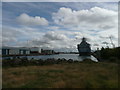
RFA Orangeleaf in West Float
West Float now terminates at Wallasey Bridge Road following the infilling of Bidston Dock. This is where this picture was taken from. RFA Orangeleaf is moored at Ilchester Wharf and saw action in both the Falklands and Gulf conflicts but was scrapped in 2016.
Image: © Colin Cheesman
Taken: 27 Sep 2009
0.15 miles
7

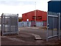
RFA Fort Rosalie (A385), West Float, Birkenhead
Berthed at Ilchester Wharf, seen from Poulton Quay next to the rowing club, with glasslike water on West Float. The helicopter hangars are clearly visible between the funnel and the stern. This replenishment ship served in the Falklands Conflict, then named RFA Fort Grange, where it was shadowed by an Argentine C-130 Hercules aircraft while still 1,000 nautical miles from the combat zone. The ship also supported British forces in the Balkans.
Image: © El Pollock
Taken: 11 Jun 2015
0.17 miles
8
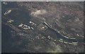
Aerial of West Float - Birkenhead
Taken from a Boeing 737-800 travelling from Dublin to Manchester
Image: © Anthony Parkes
Taken: 19 Oct 2018
0.18 miles
9
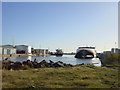
West Float from Poulton Bridge
Storage tanks and The Sea Lynx catamaran moored in West Float, taken from Poulton Bridge.
Image: © Sue Adair
Taken: 13 Nov 2005
0.18 miles
10

RFA Fort Rosalie (A385), West Float, Birkenhead
Berthed at Ilchester Wharf at about 9.30pm during the summer, seen from Cheshire's Quay over in Poulton, Wallasey. Fort Rosalie served during the Falklands Conflict and supported British forces in Split during the Balkans War.
Image: © El Pollock
Taken: 11 Jun 2015
0.19 miles