IMAGES TAKEN NEAR TO
Radstock Road, WALLASEY, CH44 2DB
Introduction
This page details the photographs taken nearby to Radstock Road, CH44 2DB by members of the Geograph project.
The Geograph project started in 2005 with the aim of publishing, organising and preserving representative images for every square kilometre of Great Britain, Ireland and the Isle of Man.

There are currently over 7.5m images from over14,400 individuals and you can help contribute to the project by visiting https://www.geograph.org.uk
Image Map
Images are licensed for reuse under creativecommons.org/licenses/by-sa/2.0
Notes
- Clicking on the map will re-center to the selected point.
- The higher the marker number, the further away the image location is from the centre of the postcode.
Image Listing (25 Images Found)
Images are licensed for reuse under creativecommons.org/licenses/by-sa/2.0
Image
Details
Distance
1
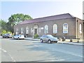
Wallasey Village Library
On St. George's Road: https://www.wirral.gov.uk/libraries-and-archives/find-library/wallasey-village-library
Image: © Mike Faherty
Taken: 4 Jul 2018
0.09 miles
3
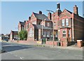
Wallasey, primary school
St. George's Primary School, on St. George's Road: http://www.stgeorges.wirral.sch.uk/
Image: © Mike Faherty
Taken: 4 Jul 2018
0.11 miles
4
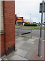
Leasowe Road/Wallasey Road roundabout
Looking past the corner of the former bank, which is now the premises of David Trowler Associates, Chartered Building Surveyors. Ordnance Survey Flush Bracket 0258S can be seen on the left of the photo Image The photo was taken from St John's Road.
Image: © John S Turner
Taken: 29 Jul 2014
0.12 miles
5
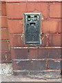
Ordnance Survey Flush Bracket 0258S
This Flush Bracket is on the St John's Road/Wallasey Road corner of David Trowler Associates Chartered Building Surveyors building. Although the flush bracket is in good condition, the hard Ruabon bricks show signs of damage from when the original hole was cut into them. See also: Image
Image: © John S Turner
Taken: 29 Jul 2014
0.13 miles
6
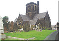
St Hilarys
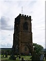
This is the Parish Church of Wallasey in the Church of England Diocese of Chester. It has always been 'black' ever since I can recall.
Image: © Nigel Freeman
Taken: 20 Oct 2004
0.16 miles
7
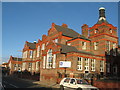
St George's Primary School, Wallasey
St George's Primary School was built in 1907.
Image: © Sue Adair
Taken: 9 Jan 2008
0.17 miles
8
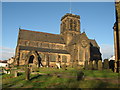
St Hilary's, Wallasey
St Hilary's is the church on the sandstone outcrop high above Wallasey Village. It is thought to have been the site of a church since the 6th century and has been rebuilt many times, the present building dates from 1858-9, the previous church having burnt down in 1857. The stone was donated from Rake Lane quarry.
Image: © Sue Adair
Taken: 9 Jan 2008
0.17 miles
9
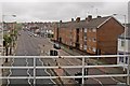
Leasowe Road, Wallasey Village
Viewed from a train on the railway bridge, just before arriving at Wallasey Village station.
Image: © El Pollock
Taken: 8 Jun 2012
0.18 miles