IMAGES TAKEN NEAR TO
St. Andrews Court, Noctorum Lane, PRENTON, CH43 7FD
Introduction
This page details the photographs taken nearby to St. Andrews Court, Noctorum Lane, CH43 7FD by members of the Geograph project.
The Geograph project started in 2005 with the aim of publishing, organising and preserving representative images for every square kilometre of Great Britain, Ireland and the Isle of Man.

There are currently over 7.5m images from over14,400 individuals and you can help contribute to the project by visiting https://www.geograph.org.uk
Image Map
Images are licensed for reuse under creativecommons.org/licenses/by-sa/2.0
Notes
- Clicking on the map will re-center to the selected point.
- The higher the marker number, the further away the image location is from the centre of the postcode.
Image Listing (13 Images Found)
Images are licensed for reuse under creativecommons.org/licenses/by-sa/2.0
Image
Details
Distance
1
Entrance to Bidston Court Gardens
These gates have become rusty in recent times, and the plaque to the left of them bearing the name of this park has disappeared. When I was a child this was a lovely place to come and play, particularly in the winter when snow fell and sledding was to be had here. I believe that it has become something of a haven for drug addicts and alcoholics over the last few years, which is something of a shame.
Image: © Fractal Angel
Taken: 16 Aug 2007
0.12 miles
2
Footpath steps
Steps leading from Vyner Road South to Noctorum.
Image: © David Quinn
Taken: 24 Jul 2007
0.12 miles
3
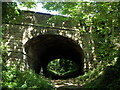
Road-Bridge
The bridge carries Vyner Road South over what is now a footpath, although the footpath could have once been a stream.
Image: © David Quinn
Taken: 24 Jul 2007
0.13 miles
4
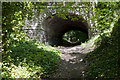
The footpath uses a tunnel under the road
Image: © Ian Greig
Taken: 26 May 2017
0.15 miles
5
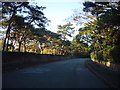
Vyner Road South, Bidston
Heavily wooded road on the side of Bidston Hill, its large Victorian residences behind high sandstone walls, are nowadays mainly occupied by care homes.
Image: © Sue Adair
Taken: 13 Nov 2005
0.16 miles
6

Knotweed (Fallopia japonica) in the Pass of Thermopylae
The ubiquitous Japanese intruder gets everywhere. Here it is flanking the wooded path that leads off Upton Road.
Image: © Tiger
Taken: 12 Jun 2010
0.17 miles
7
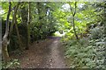
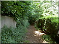
Footpath off Upton Road
This shortcut (avoiding a busy road) has a set of very steep steps -- not for the unfit!
Image: © Fractal Angel
Taken: 16 Aug 2007
0.19 miles
8
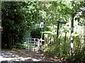
Footpath Junction and Kissing gate.
Both footpaths go straight across the golf course, mind the golf balls!
Image: © David Quinn
Taken: 24 Jul 2007
0.20 miles
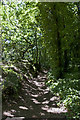
10
Footpath in Wirral Ladies
The footpath is first behind a safety bush, before it cuts straight through the golf course, and in-between different holes.
Image: © David Quinn
Taken: 24 Jul 2007
0.21 miles