IMAGES TAKEN NEAR TO
Talbot Court, PRENTON, CH43 6UE
Introduction
This page details the photographs taken nearby to Talbot Court, CH43 6UE by members of the Geograph project.
The Geograph project started in 2005 with the aim of publishing, organising and preserving representative images for every square kilometre of Great Britain, Ireland and the Isle of Man.

There are currently over 7.5m images from over14,400 individuals and you can help contribute to the project by visiting https://www.geograph.org.uk
Image Map
Images are licensed for reuse under creativecommons.org/licenses/by-sa/2.0
Notes
- Clicking on the map will re-center to the selected point.
- The higher the marker number, the further away the image location is from the centre of the postcode.
Image Listing (27 Images Found)
Images are licensed for reuse under creativecommons.org/licenses/by-sa/2.0
Image
Details
Distance

2
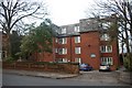
Bushell Court
Retirement housing in Shrewsbury Road, built in 1977; the name commemorates Warin Foster Bushell (1885-1974), former Headmaster of Birkenhead School. http://en.wikipedia.org/wiki/Warin_Foster_Bushell
Image: © Tiger
Taken: 25 Dec 2008
0.08 miles
3
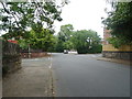
Gerald Road, Birkenhead
Looking north east.
Image: © JThomas
Taken: 25 May 2019
0.09 miles
4
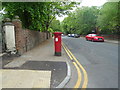
Shrewsbury Road, Birkenhead
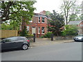
Showing position of Postbox No. CH43 159.
Image: © JThomas
Taken: 25 May 2019
0.10 miles
6
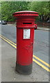
Victorian postbox on Shrewsbury Road, Birkenhead
Postbox No. CH43 159.
Image: © JThomas
Taken: 25 May 2019
0.11 miles
7
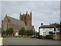
St. Saviour's Church, Oxton
St Saviour's Church is on the corner of Gerald Road and Bidston Road, Oxton. It has a commanding position upon Oxton Ridge, overlooking Birkenhead, the Mersey and Liverpool to the East; and Wirral and North Wales to the West. The foundation stone of the present building was laid by Miss Catherine King on 26th March 1889 and the church was consecrated on Ascension Day 1892.
Image: © Sue Adair
Taken: 22 Oct 2005
0.13 miles
8
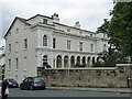
20-24 Village Road, Birkenhead
A trio of mid-C19th houses spanned by a loggia in the centre of Oxton. Grade II listed.
Image: © Stephen Richards
Taken: 21 Aug 2014
0.13 miles
9
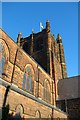
Tower of St Saviour's Church, Oxton
St George's flag flies from the red sandstone tower on Christmas Day. The present church was completed in 1892 to designs by Harvey, Pennington and Bridgen to replace an earlier church of 1846 which had been rendered too small by the rapidly growing congregation of the Victorian Birkenhead suburbs. Before that date Oxton had been part of the medieval parish of Woodchurch. http://www.oxtonstsaviour.co.uk/
Image: © Tiger
Taken: 25 Dec 2009
0.16 miles