
IMAGES TAKEN NEAR TO
Durley Drive, PRENTON, CH43 3BD
Introduction
This page details the photographs taken nearby to Durley Drive, CH43 3BD by members of the Geograph project.
The Geograph project started in 2005 with the aim of publishing, organising and preserving representative images for every square kilometre of Great Britain, Ireland and the Isle of Man.

There are currently over 7.5m images from over14,400 individuals and you can help contribute to the project by visiting https://www.geograph.org.uk
Image Map
Images are licensed for reuse under creativecommons.org/licenses/by-sa/2.0
Notes
- Clicking on the map will re-center to the selected point.
- The higher the marker number, the further away the image location is from the centre of the postcode.
Image Listing (9 Images Found)
Images are licensed for reuse under creativecommons.org/licenses/by-sa/2.0
Image
Details
Distance
1
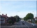
Railway bridge crosses Woodchurch Road at Prenton
The railway runs between Bidston and Wrexham
Image: © Raymond Knapman
Taken: 6 Sep 2012
0.06 miles
3
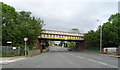
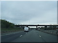
Fifteen Foot Three Inches
Railway bridge crosses Woodchurch Road (A552) at Prenton.
Image: © J Scott
Taken: 16 Nov 2010
0.07 miles
4
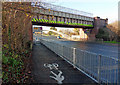
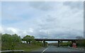
Divided By Two
Cycleway footpath leading from Woodchurch Road (A552) to Durley Drive, Prenton.
Image: © J Scott
Taken: 16 Nov 2010
0.07 miles
5
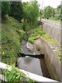
Water Course
Culverted Prenton Brook along side Prenton Way on the Durley Estate.
Image: © J Scott
Taken: 15 Aug 2006
0.15 miles
8
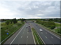
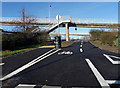
M53 Motorway northbound
View from the bridge on the A552.
Image: © JThomas
Taken: 15 Jun 2019
0.21 miles
9
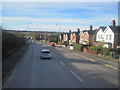
Woodchurch Road Prenton
Woodchurch Road Prenton looking down into the Fender valley which now houses junction 3 of the M53 motorway and the Borderlands (Wrexham to Bidston) railway. The line opened in 1896, as the North Wales & Liverpool Railway alongside the river which flows north to join the Birket at Leasowe. In the distance can be seen the fields of the ancient hamlet of Landican and to the right Arrowe Park Hospital.
Image: © Sue Adair
Taken: 21 Nov 2015
0.25 miles