
IMAGES TAKEN NEAR TO
Forest Road, PRENTON, CH43 1UH
Introduction
This page details the photographs taken nearby to Forest Road, CH43 1UH by members of the Geograph project.
The Geograph project started in 2005 with the aim of publishing, organising and preserving representative images for every square kilometre of Great Britain, Ireland and the Isle of Man.

There are currently over 7.5m images from over14,400 individuals and you can help contribute to the project by visiting https://www.geograph.org.uk
Image Map
Images are licensed for reuse under creativecommons.org/licenses/by-sa/2.0
Notes
- Clicking on the map will re-center to the selected point.
- The higher the marker number, the further away the image location is from the centre of the postcode.
Image Listing (13 Images Found)
Images are licensed for reuse under creativecommons.org/licenses/by-sa/2.0
Image
Details
Distance
1
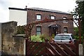
House in Sandy Way
The extension to this house does not appear to blend particularly well with the original architecture.
Image: © Fractal Angel
Taken: 17 Aug 2007
0.06 miles
2
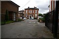
Belgrano, 86 Devonshire Place
The main building of Birkenhead High School GDST (Girls' Day School Trust), an independent girls' school which has been in operation for around 100 years. GDST schools boast some of the best GSCE and A-level exam results in the country, and one or other of them frequently heads the league tables.
Image: © Fractal Angel
Taken: 17 Aug 2007
0.08 miles
3
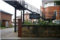
Entrance to Birkenhead High School GDST
Showing the sign, the bridge from the Junior Department, the main administrative building, the library (on the left) and what I believe to be the new Music and Drama building on the right.
Image: © Fractal Angel
Taken: 17 Aug 2007
0.08 miles
4
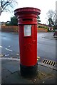
Victorian pillar box
One of a number of Victorian survivals in the neighbourhood, this example stands at the corner of Howbeck and Shrewsbury Roads.
Image: © Tiger
Taken: 25 Dec 2007
0.09 miles
5
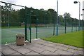
Birkenhead Lawn Tennis Club
This is now owned by Birkenhead High School GDST. Several changes appear to have been made over the last 15-20 years, most notably and regrettably the removal of the three remaining grass courts to be replaced by (as pictured here) painted tarmac.
Image: © Fractal Angel
Taken: 17 Aug 2007
0.09 miles
6
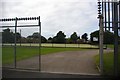
Sports field for Birkenhead High School GDST
What's the point of erecting all that fearsome looking razor wire etc. and then leaving the gate open?!
Image: © Fractal Angel
Taken: 17 Aug 2007
0.10 miles
7
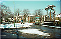
Roundabout at Egerton Road
A Birkenhead Corporation bus on the anticlockwise North Circle route 94 negotiates the hourglass shaped roundabout at the junction Egerton Road and Tollemache Road (rear left). Until just a few years previously this had been simply a wide open space of road which in the other direction could be swept through at speed to take a run at the ensuing gradient on Tollemache Road.
Birkenhead Corporation would lose control of its buses in a couple of years' time with the formation of the Merseyside PTE.
This is one of a series of views featuring buses in the 60s, 70s, and 80s. http://www.geograph.org.uk/search.php?i=2114547&displayclass=slide
Image: © Alan Murray-Rust
Taken: 7 Mar 1970
0.11 miles
8
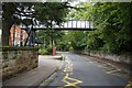
Bridge across Devonshire Place
This bridge was constructed to allow children from the Junior Department of Birkenhead High School GDST to cross safely to the main site for their lunch. This was after a series of accidents/near-misses.
Image: © Fractal Angel
Taken: 17 Aug 2007
0.11 miles
9
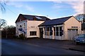
Garage
This Volvo dealer's garage in Shrewsbury Road looks as if it may originally have been a chapel.
Image: © Tiger
Taken: 25 Dec 2007
0.11 miles
10
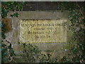
Stone plaque marking the site of St Aidan's College
St Aidan's Theological College was a large brick building built in the Tudor style, which taught Anglican students of theology. It is now demolished, and replaced by housing on the site. This plaque in one of the original walls surrounding the site is located approximately 100 metres north of the original building.
Image: © Robin Lucas
Taken: 28 Jan 2011
0.12 miles