
IMAGES TAKEN NEAR TO
Briardale Road, BIRKENHEAD, CH42 9NF
Introduction
This page details the photographs taken nearby to Briardale Road, CH42 9NF by members of the Geograph project.
The Geograph project started in 2005 with the aim of publishing, organising and preserving representative images for every square kilometre of Great Britain, Ireland and the Isle of Man.

There are currently over 7.5m images from over14,400 individuals and you can help contribute to the project by visiting https://www.geograph.org.uk
Image Map
Images are licensed for reuse under creativecommons.org/licenses/by-sa/2.0
Notes
- Clicking on the map will re-center to the selected point.
- The higher the marker number, the further away the image location is from the centre of the postcode.
Image Listing (15 Images Found)
Images are licensed for reuse under creativecommons.org/licenses/by-sa/2.0
Image
Details
Distance
1
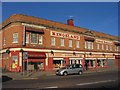
Kingsland Cabaret Restaurant, Birkenhead
According to Wikipedia, the main entrance to the restaurant is actually a grand fireplace removed from an old building, also called 'Kingsland'.
On the ground floor, there is a furniture shop called 'Suite Sensation'.
Image: © Peter Craine
Taken: 3 Nov 2006
0.09 miles
3
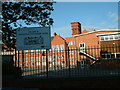
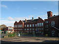
Woodchurch Road Primary School, Birkenhead
Image: © Robin Lucas
Taken: 20 Aug 2006
0.14 miles
4
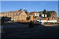
Redevelopment, Glenda Jackson Theatre site
The photo shows the site of the old technical college theatre, latterly named Glenda Jackson Theatre after the famous actress and M.P. who was born in Birkenhead. It has only been revealed in the last few years that this was a Civil Defence Corps Control Centre during the Cold War. The bunker was later converted into a recording studio. More info & pic can be found at http://www.subbrit.org.uk/rsg/sites/b/birkenhead/index.html
Image: © Peter Craine
Taken: 3 Nov 2006
0.15 miles
5
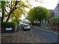
Kings Mount
At its junction with James Street.
Image: © John Allan
Taken: 19 Oct 2012
0.15 miles
7
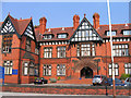
Wirral Christian Centre
This was converted from a children's hospital to a religious centre in the seventies. It also provides services such as residential home, nursery and luncheon club. Located on Woodchurch Road in Birkenhead.
Image: © Peter Craine
Taken: 19 Jul 2006
0.17 miles
9
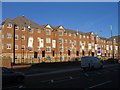
Eaton Place apartments, Birkenhead
These apartments, on Borough Road, have replaced the old technical college AKA Wirral Metropolitan College. The building was abandoned, left to decay, and the whole site has been demolished and rebuilt over the past year. Wirral Metropolitan College still exists, but in locations in Conway Park and Twelve Quays.
Image: © Peter Craine
Taken: 3 Nov 2006
0.21 miles
10
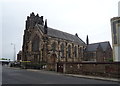
Oxton Congregational Church
A Grade II active Elim Pentecostal Church.
Image: © JThomas
Taken: 25 May 2019
0.22 miles