
IMAGES TAKEN NEAR TO
Park Road, BIRKENHEAD, CH42 5NR
Introduction
This page details the photographs taken nearby to Park Road, CH42 5NR by members of the Geograph project.
The Geograph project started in 2005 with the aim of publishing, organising and preserving representative images for every square kilometre of Great Britain, Ireland and the Isle of Man.

There are currently over 7.5m images from over14,400 individuals and you can help contribute to the project by visiting https://www.geograph.org.uk
Image Map
Images are licensed for reuse under creativecommons.org/licenses/by-sa/2.0
Notes
- Clicking on the map will re-center to the selected point.
- The higher the marker number, the further away the image location is from the centre of the postcode.
Image Listing (25 Images Found)
Images are licensed for reuse under creativecommons.org/licenses/by-sa/2.0
Image
Details
Distance
1

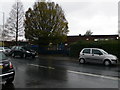
Children's Playground, Mersey Park, Higher Tranmere
Image: © Sue Adair
Taken: 10 Jan 2007
0.09 miles
3

Mersey Park Moonlit
Mersey Park, with the sky lit up by the Moon. The reflection on the River Mersey can be seen in the distance.
Image: © mezmrz
Taken: 10 Mar 2009
0.13 miles
5

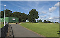
Mersey Park, Tranmere
The Mersey Park footpath entrance at the easterly bottom end of Downham Road. Local viewers may notice the unusual directions of the shadows. This pic was taken at 6.14am on 5th May, 2003.
Image: © mezmrz
Taken: 5 May 2003
0.14 miles
6
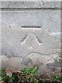
Bench mark on the former Well Lane police station, Rock Ferry
This Ordnance Survey bench mark is on the former police station in Well Lane, Rock Ferry. The building has been put up for sale and the site may be redeveloped. See also Image
Image: © John S Turner
Taken: 8 Dec 2018
0.16 miles
7
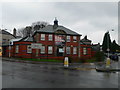
Well Lane Police Station, Tranmere
Sited at the eastern end of Victoria Park, on the junction of Well Lane and Albany Road.
Image: © Eirian Evans
Taken: 17 Nov 2010
0.16 miles
8
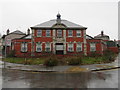
Former Well Lane police station, Rock Ferry
Looking towards the former police station in Well Lane, Rock Ferry. The building was put up for sale in 2015 and may be redeveloped. There is an Ordnance Survey bench mark on the right hand corner of the main building - Image
Image: © John S Turner
Taken: 8 Dec 2018
0.16 miles
10
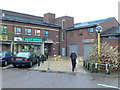
Rock Ferry shopping precinct
A small collection of shops on Old Chester Road, including the Post Office and Library.
Image: © Eirian Evans
Taken: 17 Nov 2010
0.18 miles