
IMAGES TAKEN NEAR TO
Highfield South, BIRKENHEAD, CH42 4NF
Introduction
This page details the photographs taken nearby to Highfield South, CH42 4NF by members of the Geograph project.
The Geograph project started in 2005 with the aim of publishing, organising and preserving representative images for every square kilometre of Great Britain, Ireland and the Isle of Man.

There are currently over 7.5m images from over14,400 individuals and you can help contribute to the project by visiting https://www.geograph.org.uk
Image Map
Images are licensed for reuse under creativecommons.org/licenses/by-sa/2.0
Notes
- Clicking on the map will re-center to the selected point.
- The higher the marker number, the further away the image location is from the centre of the postcode.
Image Listing (14 Images Found)
Images are licensed for reuse under creativecommons.org/licenses/by-sa/2.0
Image
Details
Distance
1
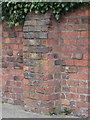
Weathered bench mark at #88 Highfield South
There is an Ordnance Survey bench mark on the buttress of this wall, next to the drive of #88 Highfield South.
Image: © John S Turner
Taken: 21 Mar 2016
0.03 miles
2
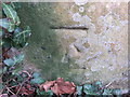
Weathered bench mark in Highfield South
This weathered bench mark is on a gatepost set back in a semi-circle from Highfield South. Image Image
Image: © John S Turner
Taken: 21 Mar 2016
0.13 miles
3
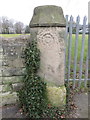
Weathered gatepost in Highfield South
This weathered gatepost is set back from Highfield South. The 'smiley face' at the top of the post seems to have been caused by the weathering of the original design. There is an Ordnance Survey bench mark at the foot of the post - Image
Image: © John S Turner
Taken: 21 Mar 2016
0.13 miles
4
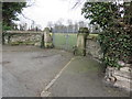
Gateway in Highfield South
This locked gateway provides access to the school playing fields from Highfield South. There is an Ordnance Survey bench mark at the base of the far gatepost - Image
Image: © John S Turner
Taken: 21 Mar 2016
0.13 miles
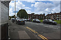
6
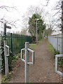
Footpath from Highfield South
This footpath links Highfield South and Old Chester Road.
Image: © John S Turner
Taken: 21 Mar 2016
0.16 miles
7
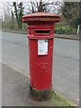
Victorian post box in Highfield South
This Victorian post box is in Highfield South, opposite a footpath. The casting shows that it was made by Handyside & Co, Derby & London, and it appears first on the 1899 O.S. map. The post box reference is CH42 151D.
Image: © John S Turner
Taken: 21 Mar 2016
0.19 miles
9
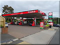
Service station on Old Chester Road, Bebington
Image: © JThomas
Taken: 15 Jun 2019
0.21 miles
10
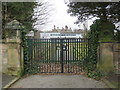
Gateway in Highfield South
This locked gateway provides access from Highfield South to Birkenhead University Academy playing fields.
Image: © John S Turner
Taken: 21 Mar 2016
0.22 miles