
IMAGES TAKEN NEAR TO
Rock Park Road, BIRKENHEAD, CH42 1PP
Introduction
This page details the photographs taken nearby to Rock Park Road, CH42 1PP by members of the Geograph project.
The Geograph project started in 2005 with the aim of publishing, organising and preserving representative images for every square kilometre of Great Britain, Ireland and the Isle of Man.

There are currently over 7.5m images from over14,400 individuals and you can help contribute to the project by visiting https://www.geograph.org.uk
Image Map
Images are licensed for reuse under creativecommons.org/licenses/by-sa/2.0
Notes
- Clicking on the map will re-center to the selected point.
- The higher the marker number, the further away the image location is from the centre of the postcode.
Image Listing (46 Images Found)
Images are licensed for reuse under creativecommons.org/licenses/by-sa/2.0
Image
Details
Distance
1
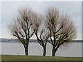
Three trees in Rock Park, Rock Ferry
This open grassy area in Rock Park has three distinctive trees standing alongside the River Mersey.
Image: © John S Turner
Taken: 21 Mar 2016
0.04 miles
2
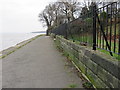
Rock Ferry Esplanade
Looking south east along Rock Ferry Esplanade below #19 Rock Park. There is an arrowhead cut into the stone wall on the right, which is in the correct position to be an Ordnance Survey bench mark - Image
Image: © John S Turner
Taken: 27 Feb 2016
0.06 miles
3
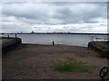
River Mersey foreshore, Rock Park
Looking across to Liverpool.
Image: © JThomas
Taken: 15 Jun 2019
0.09 miles
4
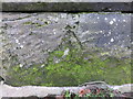
An unconvincing bench mark on Rock Ferry Esplanade
This arrow head, cut into the stone wall alongside the Rock Ferry Esplanade doesn't look good enough to be an Ordnance Survey bench mark, however, it is in the correct position for a recorded mark between #18 and #19 Rock Park. See also Image
Image: © John S Turner
Taken: 27 Feb 2016
0.09 miles
5
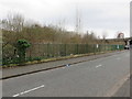
The site of The Dell Middle and Primary Schools
Looking across The Dell to the site of The Dell Middle and Primary Schools, now demolished. A sign on the old school gate states that the site has been 'Aquired (sic) for Clients' - Image
Image: © John S Turner
Taken: 21 Mar 2016
0.09 miles
6
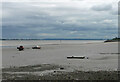
River Mersey
Looking south-east from the Rock Ferry area.
Image: © Stephen Richards
Taken: 21 Aug 2014
0.10 miles
7
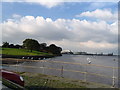
Banks of the River Mersey at Rock Ferry
In the distance oil terminal and Rock Ferry Pier - note car (DUKW?) in river
Image: © Ron Gooding
Taken: 16 Oct 2004
0.10 miles
8
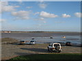
The Mersey at New Ferry
The Mersey at New Ferry, looking across to Mossley Hill church in the centre frame.
Image: © Sue Adair
Taken: 17 Jan 2007
0.10 miles
9
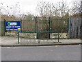
Former school gate in The Dell, Rock Ferry
Looking across The Dell towards the former school gate of The Dell Middle and Primary Schools. The internet records that the school was closed on 31st August 2006, and it has now been demolished. The sign states that the site has been 'Aquired (sic) for Clients'. Ron Gooding's photo shows the school in 2004 Image
Image: © John S Turner
Taken: 27 Feb 2016
0.11 miles
10
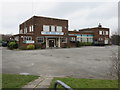
Laird's Sports Club, Rock Ferry
Looking towards Laird's Sports Club from St Peter's Road.
Image: © John S Turner
Taken: 21 Mar 2016
0.12 miles