
IMAGES TAKEN NEAR TO
Holborn Hill, BIRKENHEAD, CH41 9DJ
Introduction
This page details the photographs taken nearby to Holborn Hill, CH41 9DJ by members of the Geograph project.
The Geograph project started in 2005 with the aim of publishing, organising and preserving representative images for every square kilometre of Great Britain, Ireland and the Isle of Man.

There are currently over 7.5m images from over14,400 individuals and you can help contribute to the project by visiting https://www.geograph.org.uk
Image Map
Images are licensed for reuse under creativecommons.org/licenses/by-sa/2.0
Notes
- Clicking on the map will re-center to the selected point.
- The higher the marker number, the further away the image location is from the centre of the postcode.
Image Listing (50 Images Found)
Images are licensed for reuse under creativecommons.org/licenses/by-sa/2.0
Image
Details
Distance
1

Street name plate for Holborn Hill, Tranmere
Holborn Hill is off Queen Street, Tranmere.
Image: © John S Turner
Taken: 6 Oct 2025
0.04 miles
2

Wall corner and the ghost of a benchmark in Queen Street, Tranmere
The faintest shadow of an Ordnance Survey benchmark is still just visible on the third stone up on the corner of this old wall. The wall surrounds the grounds of the public house "The Old House at Home". The mark can be seen more clearly if the viewer looks back to the Google Streetview of August 2019.
For a wide view see: Image
Benchmark Database: https://www.bench-marks.org.uk/bm252343
Image: © John S Turner
Taken: 6 Oct 2025
0.04 miles
3

Sandstone wall in Queen Street, Tranmere
This old sandstone wall surrounds the grounds of the public house "The Old House At Home". There is a very weathered Ordnance Survey benchmark on the corner of the wall: Image
Image: © John S Turner
Taken: 6 Oct 2025
0.04 miles
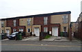
5
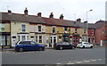
Terraced housing on Hinderton Road, Birkenhead
Image: © JThomas
Taken: 25 May 2019
0.08 miles
6
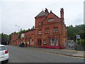
Green Lane Railway Station
Situated on the Chester and Ellesmere Port branches of the Wirral Line, part of the Merseyrail network.
Image: © JThomas
Taken: 25 May 2019
0.10 miles
7
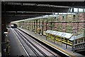
From the footbridge, Green Lane Station, Birkenhead
Up in the rafters, the view of the tracks looking to the South.
Image: © El Pollock
Taken: 8 Jun 2012
0.10 miles
8
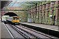
Service to Liverpool, Green Lane Station, Birkenhead
Multiple unit 507007 pulls in to the railway station, with the next train across the river.
Image: © El Pollock
Taken: 8 Jun 2012
0.11 miles
9
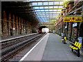
Green Lane station, Birkenhead
Looking along the Merseyrail line in the direction of Chester/Ellesmere Port. Behind the camera the line descends further to pass under the River Mersey towards Liverpool.
Image: © John S Turner
Taken: 25 May 2013
0.11 miles
10
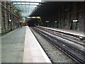
Green Lane railway station, Wirral
Opened in 1886 by the Mersey Railway as the terminus of its line from Liverpool, although it was extended southwards to Rock Ferry 5 years later. View north towards Birkenhead Central and Liverpool.
Image: © Nigel Thompson
Taken: 24 Apr 2009
0.11 miles