
IMAGES TAKEN NEAR TO
Valley Road, BIRKENHEAD, CH41 7EJ
Introduction
This page details the photographs taken nearby to Valley Road, CH41 7EJ by members of the Geograph project.
The Geograph project started in 2005 with the aim of publishing, organising and preserving representative images for every square kilometre of Great Britain, Ireland and the Isle of Man.

There are currently over 7.5m images from over14,400 individuals and you can help contribute to the project by visiting https://www.geograph.org.uk
Image Map
Images are licensed for reuse under creativecommons.org/licenses/by-sa/2.0
Notes
- Clicking on the map will re-center to the selected point.
- The higher the marker number, the further away the image location is from the centre of the postcode.
Image Listing (5 Images Found)
Images are licensed for reuse under creativecommons.org/licenses/by-sa/2.0
Image
Details
Distance

3
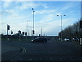
Hoylake Road/Bidston Village Road junction
Image: © Colin Pyle
Taken: 11 Feb 2014
0.18 miles
4
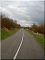
Community Woodland at Bidston Moss.
A mixture of community woodland and cyclist development on the former landfill site of Bidston Moss. The 68 hectare site has had a mixture of tree planting and a total of 4.9km length of cycle track. The site is popular with mountain cyclists and of scooter riders.
Image: © David Quinn
Taken: 16 Mar 2008
0.19 miles
5

Best picnic spot on Bidston Moss
Best bench and viewpoint on Bidston Moss.
Llandudno and the Carneddau in the frame.
Image: © mezmrz
Taken: 30 Jul 2020
0.25 miles