
IMAGES TAKEN NEAR TO
Lorn Street, BIRKENHEAD, CH41 6AR
Introduction
This page details the photographs taken nearby to Lorn Street, CH41 6AR by members of the Geograph project.
The Geograph project started in 2005 with the aim of publishing, organising and preserving representative images for every square kilometre of Great Britain, Ireland and the Isle of Man.

There are currently over 7.5m images from over14,400 individuals and you can help contribute to the project by visiting https://www.geograph.org.uk
Image Map
Images are licensed for reuse under creativecommons.org/licenses/by-sa/2.0
Notes
- Clicking on the map will re-center to the selected point.
- The higher the marker number, the further away the image location is from the centre of the postcode.
Image Listing (195 Images Found)
Images are licensed for reuse under creativecommons.org/licenses/by-sa/2.0
Image
Details
Distance
1
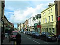
Market Street, Birkenhead
This was transformed some years ago from one of Birkenhead's most run down streets to one which is attractive and bustling. As the name suggests, the road originally led to the old market which was fire damaged in 1969 and 1974, see http://www.birkenheadmarket.co.uk/index.asp?page=3
However, the first market was actually in the space where the Wirral Museum (old town hall) is.
Image: © Peter Craine
Taken: 6 Oct 2006
0.02 miles
2
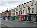
28-50 Argyle Street, Birkenhead
Terraces of flats and shops built c1840-50. Grade II listed.
Image: © Stephen Richards
Taken: 20 Aug 2014
0.03 miles
3
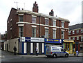
29-33 Argyle Street, Birkenhead
Probably c1840. The rounded corners and parapet lift it up a notch or two.
Shops at the time were Birkenhead Computer Repairs and Argyle News.
Image: © Stephen Richards
Taken: 20 Aug 2014
0.04 miles
4
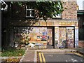
Mural on back of shop in Market Street
This is near the new post office.
Image: © Peter Craine
Taken: 6 Oct 2006
0.06 miles
5
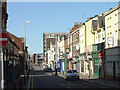
Market Street
Just one street away from Hamilton square the architecture is no longer grandiose, no longer standardised; simply as built by the developers to make money quickly from their investment.
Image: © Alan Murray-Rust
Taken: 5 Oct 2008
0.06 miles
6
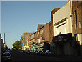
Argyle Street
Looking towards Hamilton Square.
This was originally the centre of the commercial/retail heart of Birkenhead - the renowned Birkenhead Market was a couple of blocks to the right, but the retail centre gradually migrated to the south west with the development of Grange Road and latterly the Grange Centre.
Image: © Alan Murray-Rust
Taken: 5 Oct 2008
0.07 miles
7
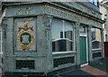
Former Pier Hotel, Birkenhead
No longer a pub but retaining the superb tilework of the now closed Birkenhead Brewery, this building was refurbished and available to let when the photo was taken in Nov 2006
Image: © Tony Beattie
Taken: 1 Nov 2006
0.08 miles
8
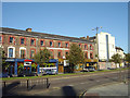
Post Office Buildings
Victorian speculative commercial development on Conway Street, close to the original main Post Office.
Image: © Alan Murray-Rust
Taken: 5 Oct 2008
0.08 miles
9
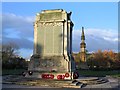
War Memorial and Victoria monument, Birkenhead
Hamilton Square. More information on the World War I cenotaph can be found here: http://www.carlscam.com/warmem/birkenhead.htm
The structure behind it is the Queen Victoria monument, see http://www.pmsa.org.uk/pmsa-database/5028/
Image: © Peter Craine
Taken: 20 Nov 2006
0.09 miles
10
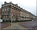
35-50 Hamilton Square, Birkenhead
This remarkably grand and complete Georgian composition is like an alien intrusion into the cityscape. Take one step outside in pretty much any direction and one is brought down to earth with a bump. The rest of William Laird's scheme never got off the ground. The square was laid out by James Gillespie Graham and construction took almost twenty years. The south side, pictured here, was built in 1839-44. Grade I listed.
Image: © Stephen Richards
Taken: 20 Aug 2014
0.09 miles