
IMAGES TAKEN NEAR TO
Argyle Street, BIRKENHEAD, CH41 6AG
Introduction
This page details the photographs taken nearby to Argyle Street, CH41 6AG by members of the Geograph project.
The Geograph project started in 2005 with the aim of publishing, organising and preserving representative images for every square kilometre of Great Britain, Ireland and the Isle of Man.

There are currently over 7.5m images from over14,400 individuals and you can help contribute to the project by visiting https://www.geograph.org.uk
Image Map
Images are licensed for reuse under creativecommons.org/licenses/by-sa/2.0
Notes
- Clicking on the map will re-center to the selected point.
- The higher the marker number, the further away the image location is from the centre of the postcode.
Image Listing (116 Images Found)
Images are licensed for reuse under creativecommons.org/licenses/by-sa/2.0
Image
Details
Distance
1
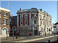
Former GPO, Argyle Street
Early 20th Century classicism. Now converted to offices, but note the fine pair of double pillar boxes still remaining.
Image: © Alan Murray-Rust
Taken: 5 Oct 2008
0.02 miles
2
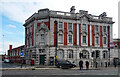
Former post office, Argyle Street, Birkenhead
A very fine example of Walter Pott's work for the Office of Works. Built 1905-06. Grade II listed.
It has been converted to offices but was possibly not occupied at the time.
Image: © Stephen Richards
Taken: 20 Aug 2014
0.03 miles
3
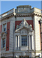
Former GPO building
Note the fine Royal Mail Edward VII monogram in the top panel.
Image: © Alan Murray-Rust
Taken: 5 Oct 2008
0.03 miles
4
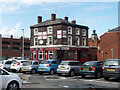
Fireman's Arms, Oliver Street East, Birkenhead
Pub, mostly surrounded by car parks.
The flags must have been in aid of the World Cup, which had finished in July.
Image: © Stephen Richards
Taken: 20 Aug 2014
0.03 miles
5
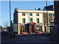
Old Post Office Hotel
A fine early Victorian public house, not too heavily rebuilt, on Argyle Street.
Image: © Alan Murray-Rust
Taken: 5 Oct 2008
0.05 miles
6
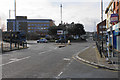
Roundabout on Argyle Street
This lies between the historic heart of the town and the newer shopping centres.
Image: © Bill Boaden
Taken: 22 Feb 2020
0.07 miles
7
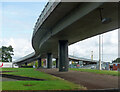
Flyover, Borough Road, Birkenhead
Carrying traffic towards central Birkenhead (left) or Chester/Mersey Tunnel (right).
Image: © Stephen Richards
Taken: 20 Aug 2014
0.07 miles
8
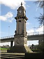
Edward VII Memorial Clock, Birkenhead
An ornate clock tower built to commemorate the life of King Edward VII. The structure is grade II listed (link: https://historicengland.org.uk/listing/the-list/list-entry/1217901 ).
Image: © Graham Robson
Taken: 2 Apr 2017
0.07 miles
9
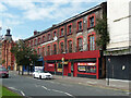
32-44 Conway Street, Birkenhead
Aka Post Office Buildings and hence perhaps once associated with this building round the corner Image
Home to a couple of clubs, The Beach/Cool Room and Bam Buddha Lounge.
Image: © Stephen Richards
Taken: 20 Aug 2014
0.08 miles
10
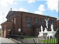
St. Werburgh's RC Church, Birkenhead
St. Werburgh's Roman Catholic church was built in 1834 and is situated on Grange Road close to the many shops of the town centre.
Image: © Sue Adair
Taken: 18 Apr 2007
0.08 miles