
IMAGES TAKEN NEAR TO
Exmouth Street, BIRKENHEAD, CH41 4NG
Introduction
This page details the photographs taken nearby to Exmouth Street, CH41 4NG by members of the Geograph project.
The Geograph project started in 2005 with the aim of publishing, organising and preserving representative images for every square kilometre of Great Britain, Ireland and the Isle of Man.

There are currently over 7.5m images from over14,400 individuals and you can help contribute to the project by visiting https://www.geograph.org.uk
Image Map
Images are licensed for reuse under creativecommons.org/licenses/by-sa/2.0
Notes
- Clicking on the map will re-center to the selected point.
- The higher the marker number, the further away the image location is from the centre of the postcode.
Image Listing (41 Images Found)
Images are licensed for reuse under creativecommons.org/licenses/by-sa/2.0
Image
Details
Distance
1
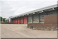
Old Birkenhead Fire Station pre-2014
This is the old Birkenhead Fire station. It had three fully staffed fire engines which were gradually cut. It was also an Operational Resource Centre housing many of Merseyside Fire Services' specialist equipment pods and an aerial appliance. It was a large building and eventually the upkeep costs and government cuts led to its being replaced with a PFI (private finance) fire station that is much smaller and shared with the ambulance service.
Image: © Ian McG
Taken: 3 Jul 2012
0.05 miles
2
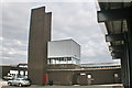
Old Birkenhead Fire Station yard and training tower
The rear of the old station, the training tower and BA training chamber.
Image: © Ian McG
Taken: 3 Jul 2012
0.05 miles
3
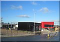
Birkenhead Community Fire Station
The Birkenhead Community Fire Station opened in 2013 and has become a hub for the local community, with children, families and community groups using the resources such as the gym; local schools and colleges use the facilities for education and fire safety activities and local groups regularly use the community rooms for meetings.
Image: © Sue Adair
Taken: 11 Jan 2014
0.05 miles
4
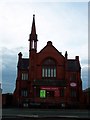
Emmanuel Holiness Church, Claughton Road, Birkenhead
Situated opposite the three car parks, on Oliver Street, which back onto Grange Road.
Image: © El Pollock
Taken: 22 Jul 2009
0.10 miles
5
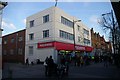
Woolworths in Birkenhead
The store in the Grange Road shopping precinct on its last day of trading, with shoppers stripping the last remaining merchandise from the shelves and in some cases buying the shelves themselves!
Image: © Tiger
Taken: 27 Dec 2008
0.13 miles
6

Asda supermarket, Birkenhead
The large Asda supermarket located in the centre of Birkenhead.
Image: © Graham Robson
Taken: 2 Apr 2017
0.13 miles
7
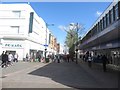
Pedestrianised shopping street, Birkenhead
The wide pedestrianised shopping street in the centre of Birkenhead, Grange Road.
Image: © Graham Robson
Taken: 2 Apr 2017
0.13 miles
8
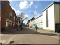
Grange Road, Birkenhead
A pedestrianised street lined with shops in the centre of Birkenhead.
Image: © Graham Robson
Taken: 2 Apr 2017
0.13 miles
9
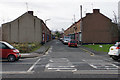
Simpson Street
A traditional terraced street partly stranded by surrounding redevelopment.
Image: © Bill Boaden
Taken: 22 Feb 2020
0.14 miles
10
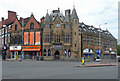
1-7 Charing Cross, Birkenhead
Built as the Bank of Liverpool, and shops, to the designs of Douglas & Minshull, 1901. The bank occupied the grandest central section (Image]). The pointiest and stand out building in the area, even if it is "uncomfortably at odds with its neighbours". Grade II listed.
The central part was occupied by Christopher Boyton, a hair salon.
Image: © Stephen Richards
Taken: 20 Aug 2014
0.14 miles