
IMAGES TAKEN NEAR TO
Claughton Road, BIRKENHEAD, CH41 4DX
Introduction
This page details the photographs taken nearby to Claughton Road, CH41 4DX by members of the Geograph project.
The Geograph project started in 2005 with the aim of publishing, organising and preserving representative images for every square kilometre of Great Britain, Ireland and the Isle of Man.

There are currently over 7.5m images from over14,400 individuals and you can help contribute to the project by visiting https://www.geograph.org.uk
Image Map
Images are licensed for reuse under creativecommons.org/licenses/by-sa/2.0
Notes
- Clicking on the map will re-center to the selected point.
- The higher the marker number, the further away the image location is from the centre of the postcode.
Image Listing (30 Images Found)
Images are licensed for reuse under creativecommons.org/licenses/by-sa/2.0
Image
Details
Distance
1
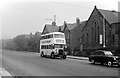
Wallasey Corporation bus 54 on Park Road East, Birkenhead ? 1966
Route 11 was one of a number of routes linking Wallasey and Birkenhead operated jointly by the two municipal transport departments. No.54 is a Leyland PD2 with Metro-Cammell bodywork, built in 1951. This was essentially a pre-war design of bodywork and was looking very old-fashioned by this time. Nevertheless, this particular bus lasted in service until 1972 when it was purchased for preservation. It now forms part of the Wirral Transport Museum collection http://www.mtps.co.uk/wallasey54.html .
To the right is St Matthews Church, which appears to have ceased to be a church from the 1970s and has been replaced with housing. It originated as a chapel of ease.
Image: © Alan Murray-Rust
Taken: 17 Oct 1965
0.09 miles
2
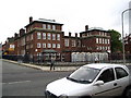
Cole Street Primary School, Birkenhead
A site visitor adds the following:
One of a number of 'inner city' schools based on a restricted space site - there are two playgrounds one at ground level and one on the roof ! - no longer used...
Image: © Ron Gooding
Taken: 17 Oct 2004
0.11 miles
3
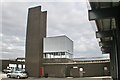
Old Birkenhead Fire Station yard and training tower
The rear of the old station, the training tower and BA training chamber.
Image: © Ian McG
Taken: 3 Jul 2012
0.11 miles
4
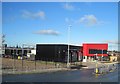
Birkenhead Community Fire Station
The Birkenhead Community Fire Station opened in 2013 and has become a hub for the local community, with children, families and community groups using the resources such as the gym; local schools and colleges use the facilities for education and fire safety activities and local groups regularly use the community rooms for meetings.
Image: © Sue Adair
Taken: 11 Jan 2014
0.11 miles
5
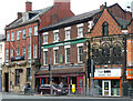
Charing Cross, Grange Road, Birkenhead
A John Smith's pub, the building looking mid C19th.
Next door is an early C20th bank building, occupied by Natwest.
Image: © Stephen Richards
Taken: 20 Aug 2014
0.12 miles
6
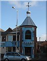
Yates' Bar, Exmouth Street
Yates' Bar in Exmouth Street with its unusual tower complete with a weather vane that looks like a kookaburra.
Image: © Sue Adair
Taken: 1 Dec 2006
0.12 miles
7
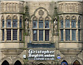
Detail of 1-7 Charing Cross, Birkenhead
Gothic detail to this building Image
Image: © Stephen Richards
Taken: 20 Aug 2014
0.12 miles
8
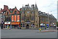
1-7 Charing Cross, Birkenhead
Built as the Bank of Liverpool, and shops, to the designs of Douglas & Minshull, 1901. The bank occupied the grandest central section (Image]). The pointiest and stand out building in the area, even if it is "uncomfortably at odds with its neighbours". Grade II listed.
The central part was occupied by Christopher Boyton, a hair salon.
Image: © Stephen Richards
Taken: 20 Aug 2014
0.12 miles
9
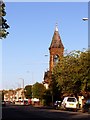
Church Of Christ, Park Road South, Birkenhead
Situated at the junction with Merton Place. Recently, badly damaged by fire & threatened with demolition.
Image: © El Pollock
Taken: 20 Jul 2009
0.13 miles
10
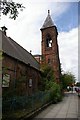
Park Christian Centre
This Grade II Listed Building at the junction of Park Road South and Merton Place was opened in 1875 as a Catholic Apostolic Church. It later became the Church of Christ and more recently the Park Christian Centre. The building was gutted by fire in June 2009 leaving only the walls and tower - Image
Image: © Fractal Angel
Taken: 17 Aug 2007
0.13 miles