
IMAGES TAKEN NEAR TO
St. Laurence Close, BIRKENHEAD, CH41 3HT
Introduction
This page details the photographs taken nearby to St. Laurence Close, CH41 3HT by members of the Geograph project.
The Geograph project started in 2005 with the aim of publishing, organising and preserving representative images for every square kilometre of Great Britain, Ireland and the Isle of Man.

There are currently over 7.5m images from over14,400 individuals and you can help contribute to the project by visiting https://www.geograph.org.uk
Image Map
Images are licensed for reuse under creativecommons.org/licenses/by-sa/2.0
Notes
- Clicking on the map will re-center to the selected point.
- The higher the marker number, the further away the image location is from the centre of the postcode.
Image Listing (54 Images Found)
Images are licensed for reuse under creativecommons.org/licenses/by-sa/2.0
Image
Details
Distance
1
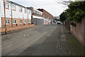
St Anne Street
An austere modern pedestrianised street.
Image: © Bill Boaden
Taken: 22 Feb 2020
0.07 miles
2
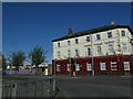
Ghost name on former Meadows Hotel, Birkenhead Park
With ornate tiling on ground floor level, this former hotel is now flats
Image: © David Smith
Taken: 28 Apr 2024
0.08 miles
3
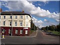
The ex Meadows Hotel on Watson Street, Birkenhead
Hotel converted into flats on road junction with Park Road North
Image: © Raymond Knapman
Taken: 30 Aug 2012
0.08 miles
4
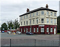
Former pub, Watson Street, Birkenhead
Once the Meadows Hotel - the lettering survives, as does the tiled ground floor.
Flats were being advertised to let.
Image: © Stephen Richards
Taken: 20 Aug 2014
0.08 miles
5
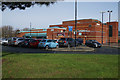
Europa Pools
A council-run leisure centre.
Image: © Bill Boaden
Taken: 22 Feb 2020
0.09 miles
6
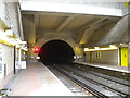
Western tunnel mouth, Conway Park station
Looking towards New Brighton and West Kirby from platform 2 of Conway Park station. Conway Park station was constructed by excavating downwards to open out a short section of the tunnel under central Birkenhead, and was opened in 1998.
Image: © Richard Vince
Taken: 5 Mar 2016
0.09 miles
7
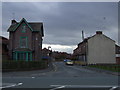
Parkfield Avenue, Birkenhead
Heading south from Conway Street.
Image: © JThomas
Taken: 1 Mar 2014
0.10 miles
8
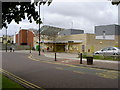
Conway Park Railway Station
Conway Park is the newest railway station on the Wirral Line which was built to provide better access to Birkenhead for rail passengers, who would otherwise just continue onto Liverpool. There are services every 15 minutes to both West Kirby and New Brighton, and services approximately every 7 minutes to Liverpool. Visible on the left-hand side of the picture is the back of Vue Cinema, another development which was built to encourage people to come to Birkenhead over the previous nearest cinemas in Liverpool and Bromborough.
Image: © David Quinn
Taken: 19 Jul 2008
0.10 miles
10
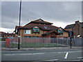
Wirral Multicultural Centre
On Conway Street.
Image: © JThomas
Taken: 1 Mar 2014
0.10 miles