IMAGES TAKEN NEAR TO
Ravensholme Lane, CHESTER, CH3 9RE
Introduction
This page details the photographs taken nearby to Ravensholme Lane, CH3 9RE by members of the Geograph project.
The Geograph project started in 2005 with the aim of publishing, organising and preserving representative images for every square kilometre of Great Britain, Ireland and the Isle of Man.

There are currently over 7.5m images from over14,400 individuals and you can help contribute to the project by visiting https://www.geograph.org.uk
Image Map
Images are licensed for reuse under creativecommons.org/licenses/by-sa/2.0
Notes
- Clicking on the map will re-center to the selected point.
- The higher the marker number, the further away the image location is from the centre of the postcode.
Image Listing (16 Images Found)
Images are licensed for reuse under creativecommons.org/licenses/by-sa/2.0
Image
Details
Distance
1
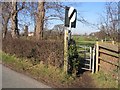
Footpath to Brook Hall
From Chester Road, Tattenhall, this footpath crosses farmland and Golborne Brook to pass Brook Hall. Brook Hall is seen between the trees to the left.
Image: © John S Turner
Taken: 7 Feb 2007
0.09 miles
2
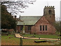
The Church of St Alban in Tattenhall
Viewed from the north-west.
Image: © Peter Wood
Taken: 2 Dec 2016
0.17 miles
3
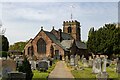
St Alban's Church
St Alban's Church in Tattenhall.
Image: © Peter McDermott
Taken: 30 Apr 2022
0.17 miles
4
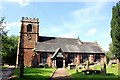
St Alban's Church, Tattenhall
It is thought that a church may have existed on this site at the time of the Norman conquest. The tower and parts of the present church date from the early 16th century. The church was restored and largely remodelled in 1869–70 by John Douglas. During this time the remains of an earlier church which had been destroyed by fire were discovered. Also discovered were a skeleton of a large man outside the north wall and a coffin containing bones under the floor of the church.
http://en.wikipedia.org/wiki/St_Alban%27s_Church,_Tattenhall
Image: © Jeff Buck
Taken: 9 Aug 2012
0.18 miles
5
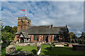
St. Alban's Church, Tattenhall
It is thought that a church may have existed on this site at the time of the Norman conquest. The tower and parts of the present church date from the early 16th century. The church was restored and largely remodelled in 1869–70. During this time the remains of an earlier church which had been destroyed by fire were discovered. Also discovered were a skeleton of a large man outside the north wall and a coffin containing bones under the floor of the church.
https://en.wikipedia.org/wiki/St_Alban%27s_Church,_Tattenhall
Image: © Brian Deegan
Taken: 10 Sep 2022
0.18 miles
6
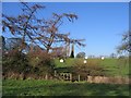
Footpath to Brook Hall
From Tattenhall the footpath to Brook Hall crosses fields and then a footbridge over a tributary of Golborne Brook. The white 'snowballs' are packed silage bales awaiting collection.
Image: © John S Turner
Taken: 7 Feb 2007
0.20 miles
7
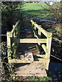
Footbridge over Golborne Brook
This footbridge is on the footpath from Tattenhall to Brook Hall. Presumably it was named after the brook in the field below.
Image: © John S Turner
Taken: 7 Feb 2007
0.20 miles
8
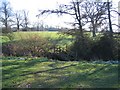
Footpath to Tattenhall
Looking across Golborne Brook on the footpath from Brook Hall to Tattenhall.
Image: © John S Turner
Taken: 7 Feb 2007
0.20 miles
9
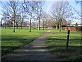
Tattenhall Park
The open space in the centre of Tattenhall. The footpath is part of the Millennium Mile walk.
Image: © John S Turner
Taken: 7 Feb 2007
0.20 miles