IMAGES TAKEN NEAR TO
Hockenhull Avenue, CHESTER, CH3 8LW
Introduction
This page details the photographs taken nearby to Hockenhull Avenue, CH3 8LW by members of the Geograph project.
The Geograph project started in 2005 with the aim of publishing, organising and preserving representative images for every square kilometre of Great Britain, Ireland and the Isle of Man.

There are currently over 7.5m images from over14,400 individuals and you can help contribute to the project by visiting https://www.geograph.org.uk
Image Map (Loading...)


Getting Data...Please wait
Leaflet Map data © OpenStreetMap
Images are licensed for reuse under creativecommons.org/licenses/by-sa/2.0
Notes
- Clicking on the map will re-center to the selected point.
- The higher the marker number, the further away the image location is from the centre of the postcode.
Image Listing (26 Images Found)
Images are licensed for reuse under creativecommons.org/licenses/by-sa/2.0
Image
Details
Distance
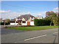
1
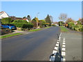
Hockenhull Lane in Tarvin
Looking north-eastward.
Image: © Peter Wood
Taken: 17 Nov 2018
0.16 miles
5
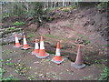
The pinfold, Tarvin
In process of being restored, though why all these cones are required when the whole thing is behind a fence tests the imagination.
Image: © Jonathan Thacker
Taken: 22 Sep 2011
0.19 miles
6
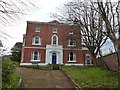
Tarvin Hall
Grade II* listed former manor house: "Formerly manor house, later school, now house: mid-late C18 (graffito date 1776 found during roof repairs) late C19 extension to rear." [https://www.historicengland.org.uk/listing/the-list/list-entry/1330303]
Image: © Dave Dunford
Taken: 14 Apr 2016
0.20 miles
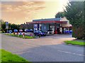
7
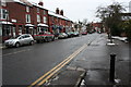
High Street, Tarvin
From the George and Dragon public house.
Image: © Dave Dunford
Taken: 10 Jan 2010
0.21 miles
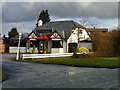
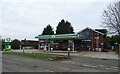
9
The New Village, Tarvin
New Village Chinese restaurant, Tarvin High Street.
Image: © David Dixon
Taken: 7 Sep 2015
0.21 miles
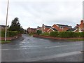
10
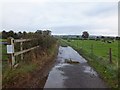
A farm track leading into Tarvin
This track is used for dog-walking and the white sign on the left is a polite and firm request to clean up after dogs to prevent still-births in the cattle. Part of the track is a public bridleway, though the whole of the track to Cross Lanes is used by cyclists and pedestrians.
Image: © David Smith
Taken: 20 Oct 2011
0.21 miles