IMAGES TAKEN NEAR TO
Lichfield Mews, High Street, CHESTER, CH3 8JL
Introduction
This page details the photographs taken nearby to Lichfield Mews, High Street, CH3 8JL by members of the Geograph project.
The Geograph project started in 2005 with the aim of publishing, organising and preserving representative images for every square kilometre of Great Britain, Ireland and the Isle of Man.

There are currently over 7.5m images from over14,400 individuals and you can help contribute to the project by visiting https://www.geograph.org.uk
Image Map
Images are licensed for reuse under creativecommons.org/licenses/by-sa/2.0
Notes
- Clicking on the map will re-center to the selected point.
- The higher the marker number, the further away the image location is from the centre of the postcode.
Image Listing (105 Images Found)
Images are licensed for reuse under creativecommons.org/licenses/by-sa/2.0
Image
Details
Distance
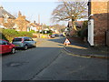
1
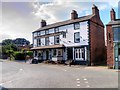
Tarvin High Street
Tarvin is a village approximately 6 miles east of Chester. It is located near the junction of the A51, towards Nantwich and Tarporley, and the A54, towards Northwich and on to Manchester. These two main trunk roads bypass the village centre on either side. The northerly A54 bypass was constructed in 1933, and the southerly A51 bypass in 1984.
The population was recorded as 2,728 at the 2011 (http://goo.gl/k7TH9K Office for National Statistics).
Image: © David Dixon
Taken: 7 Sep 2015
0.01 miles
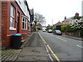
2
High Street and a hair salon sign
Some of the shops in the High Street have modern signs such as this, symbols of the trade of the business.
Image: © David Smith
Taken: 20 Oct 2011
0.01 miles
3
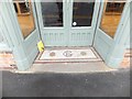
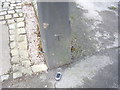
The mosaic threshold of a shop in the High Street
Although the original business is there no longer, the threshold remains. Is it early 20th century?
Image: © David Smith
Taken: 20 Oct 2011
0.02 miles
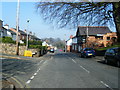
4
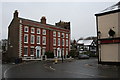
High Street in Tarvin
Looking north-eastward.
Image: © Peter Wood
Taken: 17 Nov 2018
0.02 miles
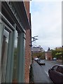
8
Cut Mark on Gatepost, Tarvin High Street
OS Cut Mark on Gatepost, Tarvin High Street. Number B10688 on Benchmark Database, see: http://www.bench-marks.org.uk/bm36942
Image: © VBForever
Taken: 11 Feb 2011
0.04 miles
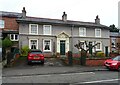
9
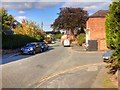
Village centre, Tarvin
Taken outside the George and Dragon pub.
Image: © Dave Dunford
Taken: 10 Jan 2010
0.04 miles