
IMAGES TAKEN NEAR TO
Delamere Road, CHESTER, CH3 8BD
Introduction
This page details the photographs taken nearby to Delamere Road, CH3 8BD by members of the Geograph project.
The Geograph project started in 2005 with the aim of publishing, organising and preserving representative images for every square kilometre of Great Britain, Ireland and the Isle of Man.

There are currently over 7.5m images from over14,400 individuals and you can help contribute to the project by visiting https://www.geograph.org.uk
Image Map
Images are licensed for reuse under creativecommons.org/licenses/by-sa/2.0
Notes
- Clicking on the map will re-center to the selected point.
- The higher the marker number, the further away the image location is from the centre of the postcode.
Image Listing (35 Images Found)
Images are licensed for reuse under creativecommons.org/licenses/by-sa/2.0
Image
Details
Distance
1
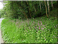
Campions by the side of Delamere Road, Mouldsworth
Image: © Stephen Craven
Taken: 1 Jun 2019
0.06 miles
2
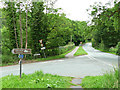
Junction of Station Road and Delamere Road, Mouldsworth
A plethora of signs includes one for a "leisure drive". The idea of driving a car only for its own sake may in years to come be seen as selfish.
Image: © Stephen Craven
Taken: 1 Jun 2019
0.07 miles
3
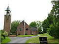
Church of St Cuthbert by the Forest, Mouldsworth
The story behind this Catholic church is that in the 1920’s there was an influx of Irish farm workers, and the landlady of the Station Hotel Image persuaded a curate from St Werburgh’s to come out and say Mass in a pavilion behind the hotel. Mass times therefore had to coincide with train times. After the war, the landlady purchased the land and St Cuthbert's was built from 1953-55 to the designs of Francis Xavier Velarde. The church, with its detached campanile, was listed grade II in 2014 (list entry 1418016). It acquired its present extended name when ‘by the Forest’ was added in 2000.
Image: © Stephen Craven
Taken: 1 Jun 2019
0.07 miles
4
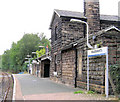
Mouldsworth station
Mouldsworth station on the Chester to Manchester line
Image: © Alan Godfree
Taken: 13 Aug 2006
0.08 miles
5
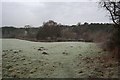
Mouldsworth from Grange Road
The start of a short footpath that links Grange Road to the B5393, viewed on a frosty January day. In the valley between here and Mouldsworth are a series of fishing lakes (not visible in this view).
Image: © Dave Dunford
Taken: 16 Jan 2016
0.10 miles
6
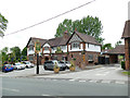
The Goshawk, Station Road, Mouldsworth
Originally called the Station Hotel, and shown as such on the 1898 OS map.
Image: © Stephen Craven
Taken: 1 Jun 2019
0.10 miles
8
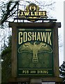
Sign for the Goshawk public house, Mouldsworth
Image: © JThomas
Taken: 20 Mar 2024
0.10 miles
9
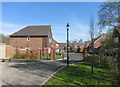
The Sidings, Mouldsworth Station
A new development with a self explanatory name.
The map shows where the track joined the main line beyond the far houses.
Image: © Des Blenkinsopp
Taken: 20 Apr 2015
0.10 miles
10
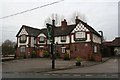
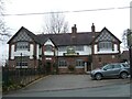
Goshawk, Mouldsworth
Originally known as the Station Inn.
Image: © Dave Dunford
Taken: 16 Jan 2016
0.11 miles