
IMAGES TAKEN NEAR TO
Houghton Close, CHESTER, CH2 3TB
Introduction
This page details the photographs taken nearby to Houghton Close, CH2 3TB by members of the Geograph project.
The Geograph project started in 2005 with the aim of publishing, organising and preserving representative images for every square kilometre of Great Britain, Ireland and the Isle of Man.

There are currently over 7.5m images from over14,400 individuals and you can help contribute to the project by visiting https://www.geograph.org.uk
Image Map
Images are licensed for reuse under creativecommons.org/licenses/by-sa/2.0
Notes
- Clicking on the map will re-center to the selected point.
- The higher the marker number, the further away the image location is from the centre of the postcode.
Image Listing (97 Images Found)
Images are licensed for reuse under creativecommons.org/licenses/by-sa/2.0
Image
Details
Distance
1
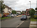
Melkridge Close 1 , Hoole
The roads in this area appear to be named after places in Northumberland, see http://en.wikipedia.org/wiki/Melkridge
Image: © Peter Craine
Taken: 16 Aug 2008
0.07 miles
2
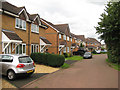
Melkridge Close 2, Hoole
The roads in this area appear to be named after places in Northumberland, see http://en.wikipedia.org/wiki/Melkridge
Image: © Peter Craine
Taken: 16 Aug 2008
0.08 miles
3
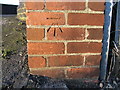
Benchmark in Brick Wall
This Benchmark can be found on the east side of the road bridge, on Hoole Lane, as it goes over the railway line for Manchester,
Image: © BrianPritchard
Taken: 24 Jan 2008
0.12 miles
4
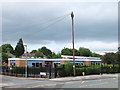
St Werburgh's and St Columba's Catholic Primary School
Possibly the longest school name in Chester?
Image: © Bill Harrison
Taken: 30 Jun 2013
0.13 miles
5
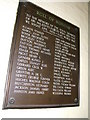
Roll of Honour, Hoole, Chester
This Roll of Honour is for the men of Hoole, who lost their lives in World War II, and is in the Hoole Community Centre on Westminster Road. It was previously displayed in the Elms Town Hall.
Image: © BrianPritchard
Taken: 2 Feb 2008
0.13 miles
6
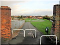
Footpath from Hoole Lane to Pentland Close, and a bench mark
This footpath provides access from Hoole Lane to a playground and the modern housing in Pentland Close. There is an Ordnance Survey bench mark on the inner face of the left hand brick pier - Image
Image: © John S Turner
Taken: 25 Nov 2011
0.14 miles
7

Railway into Chester, Hoole Park
Transport for Wales Class 197, No. 1970045.
Image: © JThomas
Taken: 2 Sep 2024
0.14 miles
8
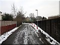
Hoole Park, Chester
Wikipedia http://en.wikipedia.org/wiki/Hoole
Image: © Jeff Buck
Taken: 24 Jan 2013
0.14 miles
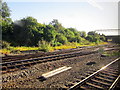
10
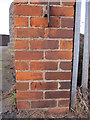
Bench mark alongside Hoole Lane
This bench mark is on a brick pier alongside Hoole Lane, in between the fork in of the railway line after it leaves Chester station. The footpath that passes the pillar now provides access to a playground and modern housing. See also: Image
Image: © John S Turner
Taken: 25 Nov 2011
0.14 miles