
IMAGES TAKEN NEAR TO
Phillip Street, CHESTER, CH2 3DA
Introduction
This page details the photographs taken nearby to Phillip Street, CH2 3DA by members of the Geograph project.
The Geograph project started in 2005 with the aim of publishing, organising and preserving representative images for every square kilometre of Great Britain, Ireland and the Isle of Man.

There are currently over 7.5m images from over14,400 individuals and you can help contribute to the project by visiting https://www.geograph.org.uk
Image Map
Images are licensed for reuse under creativecommons.org/licenses/by-sa/2.0
Notes
- Clicking on the map will re-center to the selected point.
- The higher the marker number, the further away the image location is from the centre of the postcode.
Image Listing (572 Images Found)
Images are licensed for reuse under creativecommons.org/licenses/by-sa/2.0
Image
Details
Distance
1
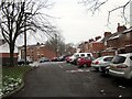
Communal Parking Area off Phillip Street, Chester
Wikipedia http://en.wikipedia.org/wiki/Hoole
Image: © Jeff Buck
Taken: 24 Jan 2013
0.01 miles
2
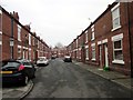
Edna Street, Hoole, Chester
Edna Street from the junction with Phillip Street.
Wikipedia http://en.wikipedia.org/wiki/Hoole
Image: © Jeff Buck
Taken: 24 Jan 2013
0.02 miles
3
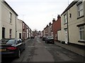
Tomkinson Street, Hoole, Chester
Tomkinson Street on the eastern side of Walker Street.
Wikipedia http://en.wikipedia.org/wiki/Hoole
Image: © Jeff Buck
Taken: 24 Jan 2013
0.04 miles
4
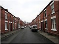
Prescot Street, Hoole, Chester
Prescot Street is divided by Faulkner Street.
Wikipedia http://en.wikipedia.org/wiki/Hoole
Image: © Jeff Buck
Taken: 24 Jan 2013
0.05 miles
5
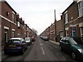
Phillip Street, Hoole, Chester
Phillip Street on the eastern side of Walker Street.
Wikipedia http://en.wikipedia.org/wiki/Hoole
Image: © Jeff Buck
Taken: 24 Jan 2013
0.05 miles
6
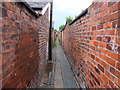
Back alleyway between terraces...
...on Lightfoot Street (left) and Phillip Street (right).
Image: © Bill Harrison
Taken: 30 Jun 2013
0.05 miles
7
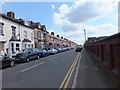
Lightfoot Street, Chester
A classic Victorian street with terrace houses of various configurations depending on the "rank" of the people who lived in the house. I have lived in "Railway" houses in Crewe and "Armstrong's Brickworks" in Newcastle upon Tyne and they are all very similar and the easy way to tell the grades is by the height of & protection for the front door. Did you wear a flat hat, bowler or high hat? I think these may have been "Railway houses".
Image] - railway houses.
Image] - Armstrong's works houses.
http://www.gracesguide.co.uk/W._G._Armstrong_and_Co
Image: © John Haynes
Taken: 30 Apr 2013
0.05 miles
8
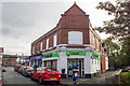
The Co-op, Walker Street, Chester
The Co-op food store in Walker Street, Chester closed on 1st November 2017 and moved to its new location on Hoole Road the following day.
Image: © Jeff Buck
Taken: 23 Oct 2017
0.05 miles
9
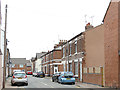
Walker Street, Chester
The houses are 19th century terraces, probably intended for railway workers, but some of them have pleasing details in the brickwork.
Image: © Stephen Craven
Taken: 1 Jun 2019
0.05 miles
10
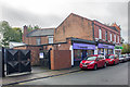
The co-operative Funeralcare and foodstore building, Walker Street
The Co-op Funeralcare and food store in Walker Street, Chester. The food store closed on 1st November 2017 and moved to its new location on Hoole Road the following day.
Image: © Jeff Buck
Taken: 23 Oct 2017
0.06 miles