Lightfoot Street, Chester
Introduction
The photograph on this page of Lightfoot Street, Chester by John Haynes as part of the Geograph project.
The Geograph project started in 2005 with the aim of publishing, organising and preserving representative images for every square kilometre of Great Britain, Ireland and the Isle of Man.

There are currently over 7.5m images from over 14,400 individuals and you can help contribute to the project by visiting https://www.geograph.org.uk
Lightfoot Street, Chester
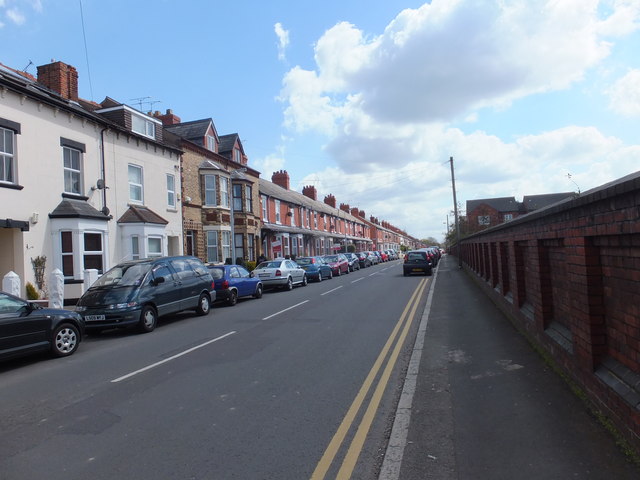
Image: © John Haynes Taken: 30 Apr 2013
A classic Victorian street with terrace houses of various configurations depending on the "rank" of the people who lived in the house. I have lived in "Railway" houses in Crewe and "Armstrong's Brickworks" in Newcastle upon Tyne and they are all very similar and the easy way to tell the grades is by the height of & protection for the front door. Did you wear a flat hat, bowler or high hat? I think these may have been "Railway houses". Image] - railway houses. Image] - Armstrong's works houses. http://www.gracesguide.co.uk/W._G._Armstrong_and_Co
Images are licensed for reuse under creativecommons.org/licenses/by-sa/2.0
Image Location


Leaflet Map data © OpenStreetMap
Latitude
53.197649
Longitude
-2.878041