
IMAGES TAKEN NEAR TO
Wroxham Close, CHESTER, CH2 2HA
Introduction
This page details the photographs taken nearby to Wroxham Close, CH2 2HA by members of the Geograph project.
The Geograph project started in 2005 with the aim of publishing, organising and preserving representative images for every square kilometre of Great Britain, Ireland and the Isle of Man.

There are currently over 7.5m images from over14,400 individuals and you can help contribute to the project by visiting https://www.geograph.org.uk
Image Map
Images are licensed for reuse under creativecommons.org/licenses/by-sa/2.0
Notes
- Clicking on the map will re-center to the selected point.
- The higher the marker number, the further away the image location is from the centre of the postcode.
Image Listing (222 Images Found)
Images are licensed for reuse under creativecommons.org/licenses/by-sa/2.0
Image
Details
Distance
2

Have You Paid and Displayed?
The answer is no as the car park no longer exists. The sign refers to Northgate car park which has now disappeared under an extra care housing development.
Image: © Jeff Buck
Taken: 30 Dec 2013
0.03 miles
6

Ex-Great Central 4-4-2T at Chester Northgate Locomotive Depot
Chester Northgate Station next door was not closed until 6/10/69, but the small Locomotive Depot lasted only until January 1960. In 1947 it had an allocation of just 12 locomotives:- 2 0-6-0, 7 4-4-2T, 3 0-6-2T, all LNER. Here Robinson C13 4-4-2T No. 7413 is half on the turntable.
Image: © Ben Brooksbank
Taken: 14 Sep 1947
0.07 miles
7
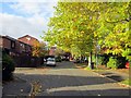
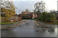
Northgate Avenue, Chester
Northgate Avenue in Northgate Village, Chester.
Image: © Jeff Buck
Taken: 24 Oct 2013
0.08 miles
8
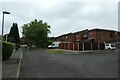
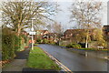
Northgate Avenue
Looking along Northgate Avenue near Northgate Ponds.
Image: © DS Pugh
Taken: 8 Aug 2020
0.08 miles
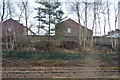
10
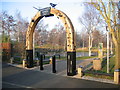
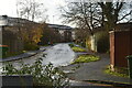
The entrance arch to Northgate Ponds
The Northgate Ponds first appeared on the 1899 O.S. map created on railway land, where they were surrounded on all sides by railway lines. The ponds are believed to have been created to store water for steam locomotives. In 2007 the area was improved as a local park, and became part of the Chester to Connahs Quay Railway Path. This arch is at the end of Northgate Avenue.
Image: © John S Turner
Taken: 19 Feb 2008
0.11 miles