
IMAGES TAKEN NEAR TO
Centurion Point, Victoria Road, CHESTER, CH2 2FD
Introduction
This page details the photographs taken nearby to Centurion Point, Victoria Road, CH2 2FD by members of the Geograph project.
The Geograph project started in 2005 with the aim of publishing, organising and preserving representative images for every square kilometre of Great Britain, Ireland and the Isle of Man.

There are currently over 7.5m images from over14,400 individuals and you can help contribute to the project by visiting https://www.geograph.org.uk
Image Map
Images are licensed for reuse under creativecommons.org/licenses/by-sa/2.0
Notes
- Clicking on the map will re-center to the selected point.
- The higher the marker number, the further away the image location is from the centre of the postcode.
Image Listing (965 Images Found)
Images are licensed for reuse under creativecommons.org/licenses/by-sa/2.0
Image
Details
Distance
1
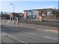
Centurion Point
Looking across Victoria Road towards the Centurion Point shopping development. The town hall clock tower can be seen in the distance on the left of the photo.
Image: © John S Turner
Taken: 1 Apr 2008
0.01 miles
2

Centurion Point, Chester
Centurion Point is a small business park situated in Victoria Road opposite the Northgate Arena.
Image: © Jeff Buck
Taken: 26 Feb 2016
0.01 miles
3
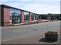
Centurion Point shops
These shops are alongside St Oswald's Way, the inner ring road.
Image: © John S Turner
Taken: 8 Jun 2008
0.01 miles
4
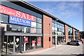
Centurion Point, Chester
Centurion Point is a small business park situated in Victoria Road opposite the Northgate Arena. This is the view from the footpath on St Oswald's Way.
Image: © Jeff Buck
Taken: 24 Feb 2016
0.02 miles
5
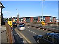
St Oswalds Way and Shops
St Oswalds Way is part of the Chester inner ring road and is permanently busy. Across the road the former B&Q store became Staples, but has now become several different shops. The tall stone spire above the shops is on top of the Northgate Church. The photo is taken from Delamere Street.
Image: © John S Turner
Taken: 18 Sep 2007
0.02 miles
6
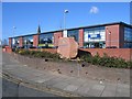
Centurion Point #2
Centurion Point shopping development seen from the junction of Victoria Road and the inner ring road, St Oswald's Way. The spire of the Northgate Church is seen above the more modern roof line. See also Image
Image: © John S Turner
Taken: 4 Mar 2008
0.02 miles
7
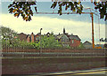
Victoria Road
This section of the road was part of the former Northgate station site which closed in the 1960s. The building in the background is the fire damaged former Abbeygate School.
Image: © Dennis Turner
Taken: 3 Jun 2008
0.03 miles
8
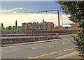
Victoria Road
The wall protected by the crash barrier is the parapet of the bridge over the Holyhead main railway line which runs in a cutting at this point prior to entering the Northgate tunnel.
Image: © Dennis Turner
Taken: 3 Jun 2008
0.03 miles
9
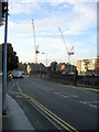
View along Victoria Road
Looking along Victoria Road between the Northgate Arena leisure centre on the left, and the Centurion Point shops on the right. The two cranes are on the development site between Delamere Street and George Street.
Image: © John S Turner
Taken: 6 Oct 2008
0.03 miles
10
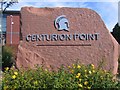
Centurion Point sign
This massive block of sandstone is on the corner of St Oswald's Way and Victoria Road in front of the Centurion Point shops. See also Image
Image: © John S Turner
Taken: 8 Jun 2008
0.03 miles