IMAGES TAKEN NEAR TO
Brook Lane, CHESTER, CH2 2EB
Introduction
This page details the photographs taken nearby to Brook Lane, CH2 2EB by members of the Geograph project.
The Geograph project started in 2005 with the aim of publishing, organising and preserving representative images for every square kilometre of Great Britain, Ireland and the Isle of Man.

There are currently over 7.5m images from over14,400 individuals and you can help contribute to the project by visiting https://www.geograph.org.uk
Image Map
Images are licensed for reuse under creativecommons.org/licenses/by-sa/2.0
Notes
- Clicking on the map will re-center to the selected point.
- The higher the marker number, the further away the image location is from the centre of the postcode.
Image Listing (68 Images Found)
Images are licensed for reuse under creativecommons.org/licenses/by-sa/2.0
Image
Details
Distance
1
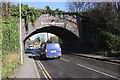
Former Railway Bridge, Ermine Road, Chester
The old railway bridge once carried the Mickle Trafford-Shotton Railway, now the Millennium Greenway.
Image: © Jeff Buck
Taken: 25 Mar 2016
0.02 miles

3
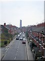
Chester - Ermine Road from the Mickle Trafford railway
Chester. View from the disused Mickle Trafford railway at the Ermine Road bridge. View along Ermine Road in the suburb of Flookersbrook. The former Chester shot tower is visible in the distance. Compare with Image taken further SE at street level.
Image: © Mike Harris
Taken: 16 Apr 2008
0.03 miles
4

The New Church
Not the age of the building, The New Church is a religious organization. This is from their website.
"Our vision is of a network of individuals and groups interacting together to share spiritual insight and understanding in an open and non-judgemental way, in order to promote spiritual growth through the application to life of the Word, and the Writings of Emanuel Swedenborg." http://en.wikipedia.org/wiki/Emanuel_Swedenborg
Image: © Des Blenkinsopp
Taken: 21 Aug 2012
0.04 miles
5

Chester New Church
Chester New Church stands at the corner of Dicksons Drive and Brook Lane.
Image: © John S Turner
Taken: 15 Oct 2017
0.04 miles
6

The New Church, Chester
The New Church situated at the junction of Dicksons Drive and Brook Lane in Newton, Chester.
Image: © Jeff Buck
Taken: 15 Jan 2015
0.04 miles
7
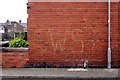
WWII Emergency Water Supply Sign (EWS)
Located at the corner of Waverley Terrace and Ermine Road, this EWS sign is barely visible after 70 years. The arrow appears to be pointing to the right which is also in the direction of the railway which would have been a potential target for the Luftwaffe during WWII.
Emergency water supplies were laid in many towns and cities to provide a source of water for extinguishing fires and incendiary bombs, should the main supplies be damaged. Many forms of pipe were used, from 6-inch iron pipes laid along gutters, to concrete shuttered trenches and canvas pipes in a metal frame. The cross-section may have been round, rectangular or square.
The water ran through these pipes from swimming pools, industrial tanks, specially built temporary tanks and even bombed-out cellars. Dammed-off rivers and streams were also used. These "Static Water Supplies" were to be found all over the place. Sometimes an "SWS" sign turns up (Static Water Supply), rather than an "EWS".
*Thanks to Russell W. Barnes and the 'Defence of Cumbria in the 20th Century' web page for the information.
Image: © Jeff Buck
Taken: 13 Mar 2012
0.05 miles
8
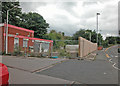
Brook Lane
Former filling station being made safe and dismantled prior to re-development.
Image: © Dennis Turner
Taken: 27 Aug 2005
0.05 miles
9
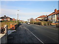
Dicksons Drive, Chester
Dicksons Drive in Newton, Chester.
Image: © Jeff Buck
Taken: 15 Jan 2015
0.06 miles