
IMAGES TAKEN NEAR TO
Ferry Lane, CHESTER, CH1 6QF
Introduction
This page details the photographs taken nearby to Ferry Lane, CH1 6QF by members of the Geograph project.
The Geograph project started in 2005 with the aim of publishing, organising and preserving representative images for every square kilometre of Great Britain, Ireland and the Isle of Man.

There are currently over 7.5m images from over14,400 individuals and you can help contribute to the project by visiting https://www.geograph.org.uk
Image Map
Images are licensed for reuse under creativecommons.org/licenses/by-sa/2.0
Notes
- Clicking on the map will re-center to the selected point.
- The higher the marker number, the further away the image location is from the centre of the postcode.
Image Listing (7 Images Found)
Images are licensed for reuse under creativecommons.org/licenses/by-sa/2.0
Image
Details
Distance
1
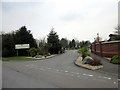
Entrance to Fir Trees Caravan Park, Chester
The entrance to Fir Trees Caravan Park off Ferry Lane near Sealand Road.
Holiday Park http://www.firtreescaravanpark.com
Image: © Jeff Buck
Taken: 12 Feb 2013
0.04 miles
2
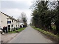
Ferry Lane, Higher Ferry, Chester
Ferry Lane as it heads towards the River Dee at Higher Ferry.
Image: © Jeff Buck
Taken: 12 Feb 2013
0.09 miles

4

Airbus Beluga XL2 leaving Hawarden Airport
The Airbus Beluga XL2 A330-743L super transporter leaving Hawarden Airport on its way back to Germany. The location of the plane is estimated based on the flight track on 'flightradar24'.
Image: © John S Turner
Taken: 20 May 2019
0.13 miles
5
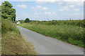
Ferry Lane
Ferry Lane runs dead straight across the flat land north of the modern course of the River Dee between Higher Ferry and Sealand Road.
Image: © Stephen McKay
Taken: 14 Jun 2018
0.15 miles
6
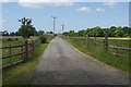
Track to Thornleigh Park Farm
The track crosses dead flat countryside leading off Ferry Lane, an area that was part of the Dee estuary until the river was diverted in the 18th century. There is a caravan site on the working farm.
Image: © Stephen McKay
Taken: 14 Jun 2018
0.19 miles
7
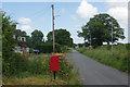
Ferry Lane
This is a curious spot in a number of ways. Bees Cottages, on the left in this view, the tiny settlement of Higher Ferry, a couple of farms and a mobile homes site are distributed along the dead straight Ferry Lane across pancake flat countryside. They are all in Flintshire but the only vehicular access is from Sealand Road across the border in England. This area, together with the rest of the community of Sealand, was once a part of the Dee Estuary until the main river channel was diverted southward to its present course in the 18th century. The border, however, follows the old course of the river creating a tiny part of Wales that is geographically part of the Wirral.
Image: © Stephen McKay
Taken: 14 Jun 2018
0.21 miles