
IMAGES TAKEN NEAR TO
Caernarfon Grove, CHESTER, CH1 5RT
Introduction
This page details the photographs taken nearby to Caernarfon Grove, CH1 5RT by members of the Geograph project.
The Geograph project started in 2005 with the aim of publishing, organising and preserving representative images for every square kilometre of Great Britain, Ireland and the Isle of Man.

There are currently over 7.5m images from over14,400 individuals and you can help contribute to the project by visiting https://www.geograph.org.uk
Image Map
Images are licensed for reuse under creativecommons.org/licenses/by-sa/2.0
Notes
- Clicking on the map will re-center to the selected point.
- The higher the marker number, the further away the image location is from the centre of the postcode.
Image Listing (23 Images Found)
Images are licensed for reuse under creativecommons.org/licenses/by-sa/2.0
Image
Details
Distance
1
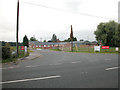
Bank Farm
Business Units at Bank Farm Sealand Road
Image: © Dennis Turner
Taken: 16 Aug 2005
0.04 miles
2
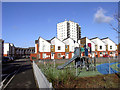
Treborth Road, Blacon
This streetscape is a change from the rather mundane housing that makes up a lot of Blacon.
Image: © Des Blenkinsopp
Taken: 31 Jan 2013
0.05 miles
4
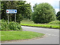
Entering England
Sign on Sealand Road (A548)
Image: © JThomas
Taken: 15 Jun 2019
0.11 miles
5
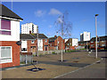
Houses and Tower Blocks, Blacon
Housing in Blacon is nearly all standard suburban style apart from three large white tower blocks which can be seen for miles.
Image: © Des Blenkinsopp
Taken: 31 Jan 2013
0.11 miles
6
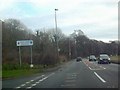
Entering England
Sign of England on the A548 near Chester
Image: © mezmrz
Taken: 16 Jan 2010
0.12 miles
7
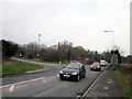
Junction of Sealand Road and Western Avenue
Wikipedia http://en.wikipedia.org/wiki/Blacon
Wikipedia http://en.wikipedia.org/wiki/Sealand,_Flintshire
Image: © Jeff Buck
Taken: 12 Feb 2013
0.12 miles
8
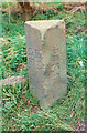
Old Boundary Marker by the A548, Sealand Road, Chester parish
County Boundary Marker by the A548, in parish of Chester (Chester District), Northwest of Bank Farm, opposite road junction with Western Avenue, on grass verge, Southwest side of road.
Surveyed
Milestone Society National ID: CH_CHQF01cb
Image: © Milestone Society
Taken: Unknown
0.12 miles
9
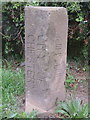
CITY OF CHESTER/FLINTSHIRE B.S. on the A548
This boundary stone marks the boundary between Chester City and Flintshire/Wales. It sits next to the modern boundary signs - Image Some time ago it had been flattened by a wayward vehicle, which is reflected in the damage, but it has now been restored to its rightful place facing across the A548 towards the Chester 1998 B.S. on the opposite side of the road - Image
Image: © John S Turner
Taken: 17 May 2017
0.13 miles
10
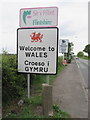
Welcome to WALES - Croeso i GYMRU on the A548
The boundary between Chester City and Flintshire/Wales is represented by the 'Sir y Fflint/Flintshire' sign, the 'Welcome to WALES/Croeso I GYMRU' sign, and a boundary stone inscribed 'CITY OF CHESTER/FLINTSHIRE' - Image
Image: © John S Turner
Taken: 17 May 2017
0.13 miles