CITY OF CHESTER/FLINTSHIRE B.S. on the A548
Introduction
The photograph on this page of CITY OF CHESTER/FLINTSHIRE B.S. on the A548 by John S Turner as part of the Geograph project.
The Geograph project started in 2005 with the aim of publishing, organising and preserving representative images for every square kilometre of Great Britain, Ireland and the Isle of Man.

There are currently over 7.5m images from over 14,400 individuals and you can help contribute to the project by visiting https://www.geograph.org.uk
CITY OF CHESTER/FLINTSHIRE B.S. on the A548
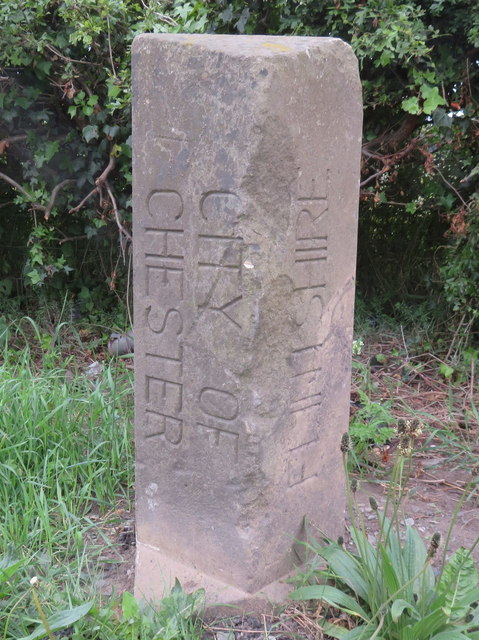
Image: © John S Turner Taken: 17 May 2017
This boundary stone marks the boundary between Chester City and Flintshire/Wales. It sits next to the modern boundary signs - Image Some time ago it had been flattened by a wayward vehicle, which is reflected in the damage, but it has now been restored to its rightful place facing across the A548 towards the Chester 1998 B.S. on the opposite side of the road - Image
Images are licensed for reuse under creativecommons.org/licenses/by-sa/2.0
Image Location
Latitude
53.199162
Longitude
-2.939