
IMAGES TAKEN NEAR TO
Parkgate Road, CHESTER, CH1 4AQ
Introduction
This page details the photographs taken nearby to Parkgate Road, CH1 4AQ by members of the Geograph project.
The Geograph project started in 2005 with the aim of publishing, organising and preserving representative images for every square kilometre of Great Britain, Ireland and the Isle of Man.

There are currently over 7.5m images from over14,400 individuals and you can help contribute to the project by visiting https://www.geograph.org.uk
Image Map
Images are licensed for reuse under creativecommons.org/licenses/by-sa/2.0
Notes
- Clicking on the map will re-center to the selected point.
- The higher the marker number, the further away the image location is from the centre of the postcode.
Image Listing (117 Images Found)
Images are licensed for reuse under creativecommons.org/licenses/by-sa/2.0
Image
Details
Distance
1
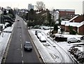
Parkgate Road, Chester
Parkgate Road from the former railway bridge which carries the Millennium Greenway.
Image: © Jeff Buck
Taken: 19 Jan 2013
0.02 miles
2
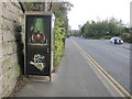
Parkgate Road, a telephone box and a bench mark
A view of Parkgate Road from below the disused railway bridge that now carries a cycleway. There is an Ordnance Survey bench mark on the wall close to the telephone box - see Image
Image: © John S Turner
Taken: 18 Oct 2011
0.02 miles
3
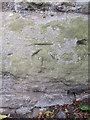
Bench mark in Parkgate Road, Chester
This bench mark is on the south east buttress of a disused railway bridge that now carries a long distance cycleway. The cut mark is near to a telephone box. See also Image
Image: © John S Turner
Taken: 18 Oct 2011
0.02 miles
4
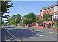
Parkgate Road
View of the east side of the road.
Image: © Dennis Turner
Taken: 31 May 2009
0.03 miles
5
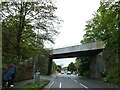
Former railway bridge over A540, northern edge of Chester
The railway has gone, the bridge carries the Millennium Greenway
Image: © David Smith
Taken: 10 May 2023
0.04 miles
6
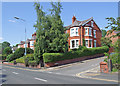
Parkgate Road
East side at the junction with Moss Bank.
Image: © Dennis Turner
Taken: 31 May 2009
0.04 miles
7
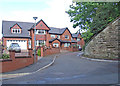
Parkgate Road
Small housing development built on the former playing fields of Queen's School Junior department and access to the Greenway.
Image: © Dennis Turner
Taken: 21 May 2009
0.06 miles
8
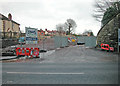
Development site
Compare with the picture after completion of the development http://www.geograph.org.uk/photo/1321059
Image: © Dennis Turner
Taken: 8 Mar 2006
0.06 miles
9
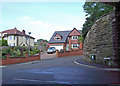
Queensgate
Grandly named housing development off Parkgate Road.
Image: © Dennis Turner
Taken: 21 May 2009
0.06 miles
10
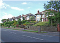
Parkgate Road
Houses on the east side of the road near Abbot's Park.
Image: © Dennis Turner
Taken: 21 May 2009
0.06 miles