
IMAGES TAKEN NEAR TO
Parkgate Road, CHESTER, CH1 4AJ
Introduction
This page details the photographs taken nearby to Parkgate Road, CH1 4AJ by members of the Geograph project.
The Geograph project started in 2005 with the aim of publishing, organising and preserving representative images for every square kilometre of Great Britain, Ireland and the Isle of Man.

There are currently over 7.5m images from over14,400 individuals and you can help contribute to the project by visiting https://www.geograph.org.uk
Image Map
Images are licensed for reuse under creativecommons.org/licenses/by-sa/2.0
Notes
- Clicking on the map will re-center to the selected point.
- The higher the marker number, the further away the image location is from the centre of the postcode.
Image Listing (113 Images Found)
Images are licensed for reuse under creativecommons.org/licenses/by-sa/2.0
Image
Details
Distance
1

Old Milepost by the A540, Parkgate Road
Cast iron post by the UC road (A540), in parish of CHESTER (CHESTER District), Parkgate Road; by No. 46, near junction with Woodlands Avenue and 80m North of junction with Abbots Park, on grass between road and footpath, on East side of road. Chester Cross iron plate & post, erected by the County Council in the 19th century.
Inscription reads:-
CHESTER CROSS
1 MILE
Grade II Listed. List Entry Number: 1375870
https://historicengland.org.uk/listing/the-list/list-entry/1375870
Milestone Society National ID: CH_WKCH17.
Image: © A Rosevear
Taken: 1 Jun 2004
0.01 miles
6

Parkgate Road
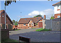
This house opposite the junction of Parkgate Road with Abbot's Park is on land bounded by the road, a disused railway converted to Greenway, a link road and drainage ditches.
Image: © Dennis Turner
Taken: 15 Mar 2009
0.06 miles
7

Abbot's Park
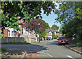
Close to its junction with Parkgate Road.
Image: © Dennis Turner
Taken: 15 Mar 2009
0.06 miles
8

Benchmark on Bache Brook Bridge, Parkgate Road
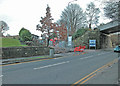
Ordnance Survey benchmark on the north east corner of Bache Brook Bridge, Parkgate Road. Bache Brook drains the low-lying land and soon becomes Finchett's Gutter, which eventually drains into the tidal River Dee via a pumping station. The mark was levelled at 7.242 metres above Newlyn Datum. For a wider view see: Image
Benchmark Database: https://www.bench-marks.org.uk/bm218155
Image: © John S Turner
Taken: 24 Aug 2016
0.07 miles
9

Bache Brook Bridge - East parapet, Parkgate Road
There is an Ordnance Survey benchmark on the North east abutment of Bache Brook Bridge, Parkgate Road Image
Image: © John S Turner
Taken: 24 Aug 2016
0.07 miles
10
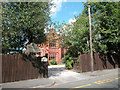
Merton House School, Abbot's Park
Grade 2 listed building adjacent to Gilwern Downswood Drive Abbot's Park Chester
Image: © Dennis Turner
Taken: 3 Aug 2005
0.09 miles