1
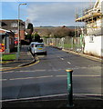
St Christopher's Close, Bedwas
On the west side of Church Street. In January 2019 scaffolding on the right is on the former Royal Oak. https://www.geograph.org.uk/photo/6035085
Image: © Jaggery
Taken: 25 Jan 2019
0.00 miles
2
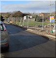
Fenced-off area in Bedwas
On the north side of St Christopher's Close at the edge of the former Royal Oak site on the corner of Church Street.
Image: © Jaggery
Taken: 25 Jan 2019
0.00 miles
3
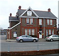
St Christopher's Close houses, Bedwas
West of Church Street.
Image: © Jaggery
Taken: 25 Jan 2019
0.01 miles
4
Co-op Bedwas
Set back from the west side of Church Street, on the corner of St Christopher's Close.
Image: © Jaggery
Taken: 25 Jan 2019
0.03 miles
5
Bedwas Police Station
Located on the east side of Church Street. The year 1910 is inscribed in stone on the pediment.
Bedwas is part of Gwent Police Force's Bedwas Neighbourhood Policing Team, which also covers Trethomas, Machen, Llanbradach and St James.
Image: © Jaggery
Taken: 5 Mar 2011
0.03 miles
6
Post Office, Church Street, Bedwas
Image: © Robin Drayton
Taken: 22 Aug 2008
0.03 miles
7
The Royal Oak, Church Street, Bedwas
Image: © Peter Gwenlan
Taken: 14 Dec 2009
0.04 miles
8
Former Royal Oak pub, Church Street, Bedwas
Viewed in January 2019. This house on the corner of St Christopher's Close
used to be the Royal Oak, seen here https://www.geograph.org.uk/photo/2600961 in September 2011.
Image: © Jaggery
Taken: 25 Jan 2019
0.04 miles
9
Church Street, Bedwas [2]
On the left is Bethel Baptist Church http://www.geograph.org.uk/photo/1162206 and just beyond, these houses http://www.geograph.org.uk/photo/1164823 .
Image: © Robin Drayton
Taken: 22 Aug 2008
0.04 miles
10
West along St Mary's Street, Bedwas
From Church Street. A National Grid van https://www.geograph.org.uk/photo/6035191 is on the left.
Image: © Jaggery
Taken: 25 Jan 2019
0.04 miles


![Church Street, Bedwas [2]](https://s0.geograph.org.uk/geophotos/01/16/70/1167072_3974f6f5_120x120.jpg)
