1
Diagonal view across rugby pitch, Chatham, Machen
A view from corner to corner across a rugby pitch in a recreation ground on the south side of the Rhymney River and A468 in Chatham, Machen. In the distance are houses on Bovil View.
Image: © Jaggery
Taken: 14 Feb 2011
0.05 miles
2
Min yr Afon houses viewed across rugby pitch, Machen
The view from the northern edge of a recreation ground towards houses built c1995, on a street named Min yr Afon.
Image: © Jaggery
Taken: 14 Feb 2011
0.05 miles
3
Machen RFC clubhouse
Clubhouse located alongside the A468, here named Chatham, in the Chatham area of Machen. The Tradesmans Arms pub http://www.geograph.org.uk/photo/2269397 is a few metres away. A sign on the wall shows Machen RFC (Rugby Football Club) 1871. The clubhouse faces rugby pitches on the far side of the Rhymney River.
Image: © Jaggery
Taken: 14 Feb 2011
0.10 miles
4
Chatham houses, Machen
Semi-detached houses on the north side of the A468, here named Chatham in the area of Machen also named Chatham. The houses face the Rhymney River. http://www.geograph.org.uk/photo/2269470
Image: © Jaggery
Taken: 14 Feb 2011
0.10 miles
5
Rhymney River downstream, Chatham, Machen
The view from a footbridge. The Rhymney here flows parallel with Chatham, the local name from the A468.
Image: © Jaggery
Taken: 14 Feb 2011
0.10 miles
6
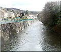
Rhymney River downstream from Tyn y Waun Road, Machen
The view downstream towards a footbridge. There is a small cascade, with a drop of about a metre, causing the water to foam. http://www.geograph.org.uk/photo/2269492 to a view upstream from the footbridge.
Image: © Jaggery
Taken: 14 Feb 2011
0.10 miles
7
Foaming Rhymney, Machen
Fast flowing after recent rain, the Rhymney River foams as it pass over a small cascade. Viewed from a footbridge looking towards the Tyn y Waun Road bridge.
http://www.geograph.org.uk/photo/2269686 to the view downstream from the road bridge.
Image: © Jaggery
Taken: 14 Feb 2011
0.10 miles
8
Rhymney River upstream from Tyn y Waun Road, Machen
Viewed from the road bridge. http://www.geograph.org.uk/photo/2269686 to the view downstream.
Image: © Jaggery
Taken: 14 Feb 2011
0.10 miles
9
Machen War Memorial
Steps enclosed in a semicircular brick wall lead up from the eastern end of Commercial Road to an enclosure containing a Celtic cross mounted on a plinth.
Image: © Jaggery
Taken: 14 Feb 2011
0.10 miles
10
Footpath alongside the River Rhymney, Machen
This footpath leads to a footbridge across the river http://www.geograph.org.uk/photo/2991398 .
Image: © Robin Drayton
Taken: 9 Jun 2012
0.11 miles


