
IMAGES TAKEN NEAR TO
William Street, CAERPHILLY, CF83 8FX
Introduction
This page details the photographs taken nearby to William Street, CF83 8FX by members of the Geograph project.
The Geograph project started in 2005 with the aim of publishing, organising and preserving representative images for every square kilometre of Great Britain, Ireland and the Isle of Man.

There are currently over 7.5m images from over14,400 individuals and you can help contribute to the project by visiting https://www.geograph.org.uk
Image Map
Images are licensed for reuse under creativecommons.org/licenses/by-sa/2.0
Notes
- Clicking on the map will re-center to the selected point.
- The higher the marker number, the further away the image location is from the centre of the postcode.
Image Listing (142 Images Found)
Images are licensed for reuse under creativecommons.org/licenses/by-sa/2.0
Image
Details
Distance
1
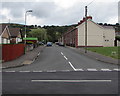
William Street, Trethomas
North along William Street from Standard Street.
Image: © Jaggery
Taken: 10 Aug 2018
0.04 miles
2
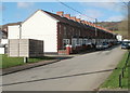
Upper Glyn Gwyn Street, Trethomas
Ahead is a 130-metre long row of houses on the west side of Upper Glyn Gwyn Street.
The east side of the street is the tree-lined edge of an open space.
Image: © Jaggery
Taken: 26 Feb 2011
0.05 miles
3
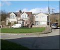
Possibly the UK's shortest High Street, Trethomas
Not a typical High Street - there are no shops, only one detached house and two semi-detached houses on High Street, Trethomas, viewed from Upper Glyn Gwyn Street. This High Street is a cul-de-sac about 23 metres long. The main shopping area in Trethomas is along Newport Road, so perhaps this street was named High Street because it is at the highest elevation in Trethomas.
The High Street name sign is on the right side of the detached house.
Image: © Jaggery
Taken: 26 Feb 2011
0.05 miles
4
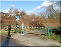
Cycleway at the NE edge of Trethomas
National Cycle Network Route 4 heads east away from Upper Glyn Gwyn Street, Trethomas.
Distances shown on the sign are 2 (miles) to Machen and 12 to Newport.
Image: © Jaggery
Taken: 26 Feb 2011
0.05 miles
5
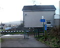
National Cycle Network route 4 reaches Trethomas
The cycleway and footpath reaches Upper Glyn Gwyn Street in the NE corner of Trethomas.
Image: © Jaggery
Taken: 26 Feb 2011
0.05 miles
6
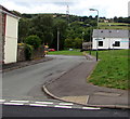
Thomas Street towards Apex House, Trethomas
Looking north from Standard Street.
Image: © Jaggery
Taken: 10 Aug 2018
0.05 miles
7

James Street, Trethomas
North along James Street from Standard Street.
Image: © Jaggery
Taken: 10 Aug 2018
0.05 miles
8
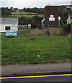
Steps up to Trethomas Health Centre
Viewed from Standard Street. The steps lead up to the health centre in William Street Trethomas.
Image: © Jaggery
Taken: 10 Aug 2018
0.05 miles
9
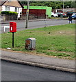
Queen Elizabeth II postbox and Royal Mail drop box, Standard Street, Trethomas
Near the corner of William Street.
Image: © Jaggery
Taken: 10 Aug 2018
0.06 miles
10
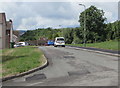
West along an unnamed side road at the northern edge of Trethomas
From Upper Glyn Gwyn Street towards William Street past the northern end of James Street.
Image: © Jaggery
Taken: 10 Aug 2018
0.06 miles