1
Brynteg, Bedwas
Brynteg is a residential street 110 metres long, between Bryn Glas and Bryntirion.
Image: © Jaggery
Taken: 5 Mar 2011
0.03 miles
2
Brynglas, Bedwas
Houses on the east side of the road, viewed from near the corner of Rectory Road.
Image: © Jaggery
Taken: 5 Mar 2011
0.04 miles
3
Bryn Goleu houses, Bedwas
Viewed from Brynglas.
Image: © Jaggery
Taken: 5 Mar 2011
0.04 miles
4
Sink on the corner of Brynglas and Bryn Goleu, Bedwas
A small stream flows into a sink.
Image: © Jaggery
Taken: 5 Mar 2011
0.04 miles
5
Change of house type, Bedwas
Looking eastwards from Brynglas towards Brynfedw.
Image: © Jaggery
Taken: 5 Mar 2011
0.05 miles
6
East along Bryntirion, Bedwas
From Church Street along Bryntirion towards Bryn Goleu, Bryn Teg and Brynglas.
Image: © Jaggery
Taken: 25 Jan 2019
0.06 miles
7
Western end of Bryntirion, Bedwas
Bryntirion houses viewed across Church Street.
Image: © Jaggery
Taken: 25 Jan 2019
0.07 miles
8
Bryn Glas in clearing morning mist
Image: © Colin Pyle
Taken: 17 Dec 2013
0.08 miles
9
Top (north) end of Church Street, Bedwas
Near the end of a long ascent from Newport Road, Church Street approaches St Barrwg's church. http://www.geograph.org.uk/photo/2787312
Image: © Jaggery
Taken: 5 Mar 2011
0.09 miles
10
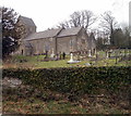
Grade II (star) listed Church of St Barrwg, Bedwas
The early medieval church is on high ground at the northern end of Church Street.
It is a Church in Wales church in the parish of Bedwas, Diocese of Monmouth.
Grade II (star) listed in 1961.
Barrwg (or Baruc) was a 6th century disciple of Saint Cadoc. Giraldus Cambrensis (Gerald of Wales) in his Itinerarium Cambriae (Journey through Wales) of 1191 stated that the Barry (at that time a hamlet, now a large town in the Vale of Glamorgan) derived its name from Baruc whose remains are deposited in a chapel on Barry Island.
Image: © Jaggery
Taken: 5 Mar 2011
0.09 miles


