1
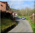
Start of the 30 zone at the eastern edge of Abertridwr
The National Speed Limit drops to 30mph near the start of houses in Bronmynydd.
Image: © Jaggery
Taken: 28 Mar 2019
0.02 miles
2
Fly Tippers Beware notice at the eastern edge of Abertridwr
On the fence here https://www.geograph.org.uk/photo/6105525 in March 2019. Fly tippers are committing a crime and face
a £50,000 maximum fine or 12 months imprisonment. The text is also in Welsh.
Image: © Jaggery
Taken: 28 Mar 2019
0.03 miles
3
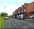
Coed-y-pica houses, Abertridwr
These are six of the ten houses in Coed-y-pica, a residential road at the SE edge of Abertridwr.
Image: © Jaggery
Taken: 1 May 2012
0.04 miles
4
End of the 30mph speed limit in Abertridwr
A few metres past the end house in Coed-y-pica, http://www.geograph.org.uk/photo/2934656 the speed limit increases from 30mph to the National Speed Limit.
Image: © Jaggery
Taken: 1 May 2012
0.04 miles
5
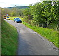
30mph speed limit in Abertridwr
The National Speed Limit along a minor road from Hendredenny Park (Caerphilly) reduces to 30mph on reaching Coed-y-Pica houses http://www.geograph.org.uk/photo/2934656 in Abertridwr.
Image: © Jaggery
Taken: 1 May 2012
0.04 miles
6
Aber Cycleway at rear of Coedcae Road
Ramp access to Cycleway (NCR 475), on track bed of the defunct Aber Branch of the Rhymney Railway, from lane at rear of Coedcae Road.
Image: © M J Roscoe
Taken: 11 Apr 2018
0.04 miles
7
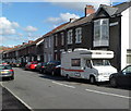
Coedcae Road, Abertridwr
Houses on the south side of Coedcae Road viewed from the corner of Aberfawr Road.
Image: © Jaggery
Taken: 1 May 2012
0.06 miles
8
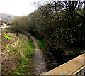
Former railway route in Abertridwr
Looking east from this https://www.geograph.org.uk/photo/6118333 bridge. Passenger services in this area ended in 1964.
Image: © Jaggery
Taken: 28 Mar 2019
0.07 miles
9
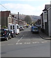
Coedcae Road, Abertridwr
Dead-end road on the east side of Aberfawr Road.
Image: © Jaggery
Taken: 28 Mar 2019
0.07 miles
10
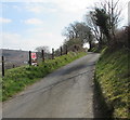
Minor road east of Abertridwr
Ahead for the Hendredenny Park area of Caerphilly. https://www.geograph.org.uk/photo/6105530 to the notice on the left.
Image: © Jaggery
Taken: 28 Mar 2019
0.07 miles


