1
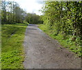
Looking towards the site of the former Abertridwr railway station
Viewed from near a road bridge http://www.geograph.org.uk/photo/2934565 over the former railway line which entered Abertridwr railway station ahead. The station closed in 1964. There are now only a few remnants hereabouts of the dismantled railway.
Image: © Jaggery
Taken: 1 May 2012
0.01 miles
2
West along a former railway route, Abertridwr
Accessed here, https://www.geograph.org.uk/photo/6118400 a combined footpath and cycleway uses a former railway route.
Passenger train services in this area ended in 1964.
Image: © Jaggery
Taken: 28 Mar 2019
0.03 miles
3
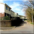
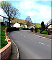
North side of Ilan Road, Abertridwr
Looking west from Aberfawr Road.
Image: © Jaggery
Taken: 28 Mar 2019
0.04 miles
4
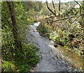
Nant Cwm-parc flows towards Aberfawr Road, Abertridwr
Viewed from this http://www.geograph.org.uk/photo/2934377 bridge. Nant is Welsh for stream.
Image: © Jaggery
Taken: 1 May 2012
0.05 miles
5
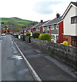
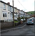
NE side of Aberfawr Terrace, Abertridwr
Semi-detached houses on this side of Aberfawr Terrace contrast with a long row of houses on the opposite side. http://www.geograph.org.uk/photo/2934699
Image: © Jaggery
Taken: 1 May 2012
0.05 miles
6
SW side of Aberfawr Terrace, Abertridwr
The long row of houses on this side of Aberfawr Terrace contrasts with the semi-detached houses http://www.geograph.org.uk/photo/2934694 on the opposite side.
Image: © Jaggery
Taken: 1 May 2012
0.05 miles
7
Small waterfall, Abertridwr
On the west side of Aberfawr Road, a stream, Nant Cwm-byr, tumbles noisily down a waterfall a few metres high. In the background are houses in Ilan Road.
Image: © Jaggery
Taken: 1 May 2012
0.06 miles
8
Nant Cwm-byr enters a culvert, Abertridwr
Viewed from a small waterfall http://www.geograph.org.uk/photo/2934535 on the north side of Ilan Road. Nant is Welsh for stream.
Image: © Jaggery
Taken: 1 May 2012
0.06 miles
9
Route of a dismantled railway line, Abertridwr
Now a footpath and cycleway, this was the route of the railway running east from the former Abertridwr railway station, which was located a few tens of metres behind the camera. Passenger services at the station ended in 1964. The bridge carries Aberfawr Road.
Image: © Jaggery
Taken: 1 May 2012
0.06 miles
10
Up Ilan Road, Abertridwr
From the corner of Bronmynydd, Ilan Road ascends
towards the Cefn Ilan Road junction ahead on the left.
Image: © Jaggery
Taken: 28 Mar 2019
0.06 miles


