
IMAGES TAKEN NEAR TO
Chester Court, CAERPHILLY, CF83 2UP
Introduction
This page details the photographs taken nearby to Chester Court, CF83 2UP by members of the Geograph project.
The Geograph project started in 2005 with the aim of publishing, organising and preserving representative images for every square kilometre of Great Britain, Ireland and the Isle of Man.

There are currently over 7.5m images from over14,400 individuals and you can help contribute to the project by visiting https://www.geograph.org.uk
Image Map
Images are licensed for reuse under creativecommons.org/licenses/by-sa/2.0
Notes
- Clicking on the map will re-center to the selected point.
- The higher the marker number, the further away the image location is from the centre of the postcode.
Image Listing (25 Images Found)
Images are licensed for reuse under creativecommons.org/licenses/by-sa/2.0
Image
Details
Distance
1
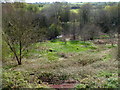
Nant-yr-Aber valley near Penyrheol, Caerphilly
A view to the SW from the B4263 into the valley of a stream, Nant-yr-Aber.
Image: © Jaggery
Taken: 1 May 2012
0.07 miles
2
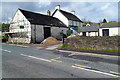
Ty Isaf Farm buildings, Penyrheol, Caerphilly
Viewed across the B4263, the road to Abertridwr and Senghenydd.
Image: © Jaggery
Taken: 1 May 2012
0.13 miles
3
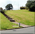
Steps up to Hendredenny houses, Caerphilly
Viewed from the junction http://www.geograph.org.uk/photo/2569899 of Hendredenny Drive and Groeswen Drive. A long flight of steps leads up to houses in the northern section of Hendredenny Park.
Image: © Jaggery
Taken: 25 Aug 2011
0.14 miles
4
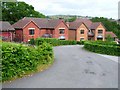
Clos Gwernydd, Hendredenny
A modern estate near Caerphilly
Image: © Oliver Dixon
Taken: 21 Jun 2006
0.15 miles
5
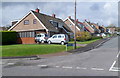
Bryn Siriol, Caerphilly
Houses on the west side of Bryn Siriol viewed from the B4263.
Image: © Jaggery
Taken: 1 May 2012
0.15 miles
6
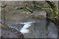
Weir on Nant Aber
Small weir just before the river turns to go underneath the Aber Cycleway (camera position).
Image: © M J Roscoe
Taken: 11 Apr 2018
0.15 miles
7
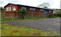
Penyrheol ACF hall, Caerphilly
The hall is on the north side of the B4263. The Penyrheol detachment is part of the Glamorgan ACF (Army Cadet Force).
Image: © Jaggery
Taken: 1 May 2012
0.16 miles
8
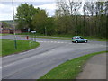
Junction of Groeswen Drive and Hendredenny Drive
Image: © John Lord
Taken: 9 May 2010
0.18 miles
9
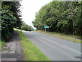
Hendredenny Drive reaches Hendredenny
Hendredenny is a suburb at the western edge of Caerphilly. Viewed from near the St Cenydd Road (B4263) end of the drive.
Image: © Jaggery
Taken: 25 Aug 2011
0.18 miles
10
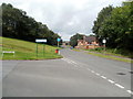
Corner of Groeswen Drive and Hendredenny Drive, Caerphilly
Groeswen Drive on the left leads to roads in the southern half of Hendredenny Park; Hendredenny Drive leads to roads in the northern half. There are no other connecting roads between the two halves, so drivers taking the wrong road need to return to this point for the right road.
Image: © Jaggery
Taken: 25 Aug 2011
0.18 miles