IMAGES TAKEN NEAR TO
Western Industrial Estate, CAERPHILLY, CF83 1XH
Introduction
This page details the photographs taken nearby to Western Industrial Estate, CF83 1XH by members of the Geograph project.
The Geograph project started in 2005 with the aim of publishing, organising and preserving representative images for every square kilometre of Great Britain, Ireland and the Isle of Man.

There are currently over 7.5m images from over14,400 individuals and you can help contribute to the project by visiting https://www.geograph.org.uk
Image Map
Images are licensed for reuse under creativecommons.org/licenses/by-sa/2.0
Notes
- Clicking on the map will re-center to the selected point.
- The higher the marker number, the further away the image location is from the centre of the postcode.
Image Listing (37 Images Found)
Images are licensed for reuse under creativecommons.org/licenses/by-sa/2.0
Image
Details
Distance
1
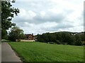
NCN4 passing the parkland, Watford Park
Image: © David Smith
Taken: 22 Sep 2022
0.08 miles
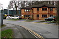
3
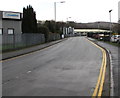
Into Western Industrial Estate, Caerphilly
Viewed near the Lon-y-llyn junction. Nuaire https://www.geograph.org.uk/photo/6025767 is on the left.
Image: © Jaggery
Taken: 11 Jan 2019
0.14 miles
5
Univar office, Caerphilly
Univar's Cardiff Sales/Southern Sales office is at the eastern edge of Western Industrial Estate near the Lon-y-llyn junction. Founded in 1924, Univar is a global chemical distributor of industrial and specialty chemicals and related chemistry services.
Image: © Jaggery
Taken: 11 Jan 2019
0.17 miles
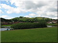
6
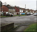
Houses on the south side of Lon-y-deri, Caerphilly
Houses on this side of the street are on the north bank of the brook Nant Gledyr.
Image: © Jaggery
Taken: 11 Jan 2019
0.18 miles
7
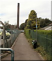
National Cycle Network Route 4, Lon-y-llyn, Caerphilly
Route 4 heads west from a road named Lon-y-llyn, past the perimeter fence of Caerphilly District Miners' Hospital. http://www.geograph.org.uk/photo/2723051
Route 4, from the Severn Bridge (Chepstow) to Swansea, is also known as The Celtic Trail (East).
Image: © Jaggery
Taken: 19 Aug 2011
0.18 miles
8
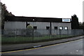
Nuaire Caerphilly
Ventilating equipment manufacturer at the eastern edge of Western Industrial Estate near the Lon-y-llyn junction.
Image: © Jaggery
Taken: 11 Jan 2019
0.19 miles
9
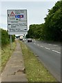
Sign for road junction
Junction at the outskirts of Caerphilly.
Image: © Alan Hughes
Taken: 5 Jun 2019
0.19 miles
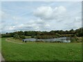
10
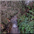
Upstream along Nant Gledyr, Caerphilly
The brook Nant Gledyr flows towards the camera on this bridge. https://www.geograph.org.uk/photo/6025809
Image: © Jaggery
Taken: 11 Jan 2019
0.19 miles