IMAGES TAKEN NEAR TO
Mardy Close, CAERPHILLY, CF83 1PW
Introduction
This page details the photographs taken nearby to Mardy Close, CF83 1PW by members of the Geograph project.
The Geograph project started in 2005 with the aim of publishing, organising and preserving representative images for every square kilometre of Great Britain, Ireland and the Isle of Man.

There are currently over 7.5m images from over14,400 individuals and you can help contribute to the project by visiting https://www.geograph.org.uk
Image Map
Images are licensed for reuse under creativecommons.org/licenses/by-sa/2.0
Notes
- Clicking on the map will re-center to the selected point.
- The higher the marker number, the further away the image location is from the centre of the postcode.
Image Listing (26 Images Found)
Images are licensed for reuse under creativecommons.org/licenses/by-sa/2.0
Image
Details
Distance
1
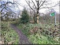
Woodland track
Public footpath to Gwern y Domen.
Image: © Alan Hughes
Taken: 17 Feb 2020
0.06 miles
3
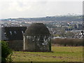
Medieval dovecote at Castell y Van
This fine medieval dovecote is well hidden from view and lies in the grounds of Castell y Van and is said to be one of the best of its kind in Britain. The best view can be obtained from the path that runs northeast towards Gwern-y-domen.
Image: © Colin Park
Taken: 19 Feb 2010
0.16 miles
4
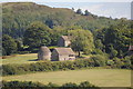
Dovecot at Castell Y Van
Post-Medieval Dovecot in the grounds of Van Mansion, a 16th century building
Image: © Peter Gwenlan
Taken: 12 Sep 2010
0.17 miles
5
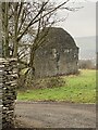
Dovecote at Van House
A Grade II listed building in the grounds of Van House.
Image: © Alan Hughes
Taken: 4 Mar 2021
0.18 miles
6
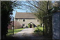
Drive to house, Farm Road, Van
Large stone built house next to Gate House, Van Castle.
Image: © M J Roscoe
Taken: 28 Mar 2019
0.18 miles
7
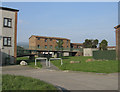
Lansbury Park Housing Estate, Caerphilly.
View from Trevelyan Court towards Maxton Court
Image: © Peter Wasp
Taken: 24 Mar 2007
0.18 miles
8
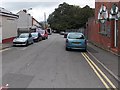
Goodrich Avenue, Caerphilly
Goodrich Avenue extends for about 100 metres from Van Road on this side to the south bank of Scouring Brook ahead. The derelict former The Goodrich pub is on the right. A notice in the doorway warns of a dangerous site. http://www.geograph.org.uk/photo/4191764
Image: © Jaggery
Taken: 3 Oct 2014
0.19 miles
9
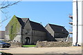
Gate House, Van Castle
The building on the left dates from the early sixteenth century as a gatehouse, grade II listed, for Van Castle (white building on right, a manor house). The wing on the north side of the gatehouse dates from the early seventeenth century and is now a separate dwelling.
Image: © M J Roscoe
Taken: 28 Mar 2019
0.19 miles