1
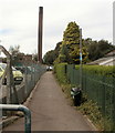
Into Western Industrial Estate, Caerphilly
Viewed near the Lon-y-llyn junction. Nuaire https://www.geograph.org.uk/photo/6025767 is on the left.
Image: © Jaggery
Taken: 11 Jan 2019
0.04 miles
2
National Cycle Network Route 4 signs, Lon-y-llyn, Caerphilly
The direction sign on the lamppost points towards St Christopher's Drive. https://www.geograph.org.uk/photo/6023104 National Cycle Route 4 extends from London to Fishguard via Reading, Bath, Bristol, Newport, Swansea, Llanelli and St Davids. Here in Wales, the route is one of the branches of the Celtic Trail cycle route.
Image: © Jaggery
Taken: 11 Jan 2019
0.06 miles
3
National Cycle Network Route 4, Lon-y-llyn, Caerphilly
Route 4 heads west from a road named Lon-y-llyn, past the perimeter fence of Caerphilly District Miners' Hospital. http://www.geograph.org.uk/photo/2723051
Route 4, from the Severn Bridge (Chepstow) to Swansea, is also known as The Celtic Trail (East).
Image: © Jaggery
Taken: 19 Aug 2011
0.06 miles
4
Moat House Inn, Caerphilly
Located at 30 Lon-y-llyn, one of more than 200 premises in the Sizzling pubs group in the UK.
Image: © Jaggery
Taken: 19 Aug 2011
0.07 miles
5
The Moat House,Caerphilly
Bar and lounge at 30 Lon-y-Llyn, a member of the Sizzling Pubs group, as shown above the name signs.
Image: © Jaggery
Taken: 21 Apr 2010
0.07 miles
6
St Christopher's Drive, Caerphilly
St Christopher's Drive orbits the housing estate, which is graced with courts named after different saints, some of whom were Welsh
Image: © David Smith
Taken: 22 Sep 2022
0.07 miles
7
Nuaire Caerphilly
Ventilating equipment manufacturer at the eastern edge of Western Industrial Estate near the Lon-y-llyn junction.
Image: © Jaggery
Taken: 11 Jan 2019
0.07 miles
8
Moat House Inn, Caerphilly
Viewed across Lon-y-Llyn on January 11th 2019 when scaffolding encases the left side of the premises.
Image: © Jaggery
Taken: 11 Jan 2019
0.07 miles
9
National Cycle Network Route 4 west of Lon-y-llyn, Caerphilly
National Cycle Route 4 extends from London to Fishguard via Reading, Bath, Bristol, Newport, Swansea, Llanelli and St Davids. Here in Wales, the route is one of the branches of the Celtic Trail cycle route.
Image: © Jaggery
Taken: 11 Jan 2019
0.07 miles
10
Lon-y-llyn bus stop, Caerphilly
In January 2019 the bus stop sign shows Route K to Caledfryn.
Image: © Jaggery
Taken: 11 Jan 2019
0.08 miles


