1
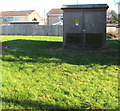
Glyn-Gaer Road electricity substation, Gelligaer
Set back from the east side of Glyn-Gaer Road, the cabinet is a Western
Power Distribution electricity substation. Its identifier is S/S 55-2767.
Image: © Jaggery
Taken: 14 Feb 2019
0.06 miles
2
Queen Elizabeth II postbox in an Oxford Street wall, Gelligaer
Behind the car on the right here. https://www.geograph.org.uk/photo/6059803
Image: © Jaggery
Taken: 14 Feb 2019
0.07 miles
3
East side of Glyn-Gaer Primary School, Gelligaer
Viewed across Glyn-Gaer Road. Oxford Street is on the right.
Image: © Jaggery
Taken: 14 Feb 2019
0.07 miles
4
End of the 20 zone, Oxford Street, Gelligaer
The 20mph speed limit near Glyn-Gaer Primary School increases
to 30mph on the approach to the Glyn-Gaer Road junction.
Image: © Jaggery
Taken: 14 Feb 2019
0.07 miles
5
Derelict former shop, Oxford Street, Gelligaer
Located near Glyn-Gaer Primary School viewed in February 2019.
The postbox https://www.geograph.org.uk/photo/6059805 in the wall behind the grey car suggest that this
may once have been a post office.
Image: © Jaggery
Taken: 14 Feb 2019
0.07 miles
6
Oaks End Close, Gelligaer
Viewed across Glyn-Gaer Road. Oaks End Close is on
the west bank of Nant Cylla, a tributary of the Rhymney River.
Image: © Jaggery
Taken: 14 Feb 2019
0.10 miles
7
Oxford Street, Gelligaer
Looking west along Oxford Street from Glyn-Gaer Road towards Commercial Street.
The houses are opposite Glyn-Gaer Primary School.
Image: © Jaggery
Taken: 14 Feb 2019
0.12 miles
8
Long row of houses, Glyn-Gaer Road, Gelligaer
Extending for 80 metres from Oxford Street to Commercial Street.
Image: © Jaggery
Taken: 14 Feb 2019
0.12 miles
9
Wales & West Utilities gas installation on a Gelligaer corner
In a locked green enclosure on the corner of Commercial Street and Glyn-Gaer Road.
Image: © Jaggery
Taken: 14 Feb 2019
0.14 miles
10
Turning area at the SW end of Royce Close, Penpedairheol
The brook Nant Cylla is behind the houses.
Image: © Jaggery
Taken: 22 Aug 2019
0.15 miles


